alb3549693
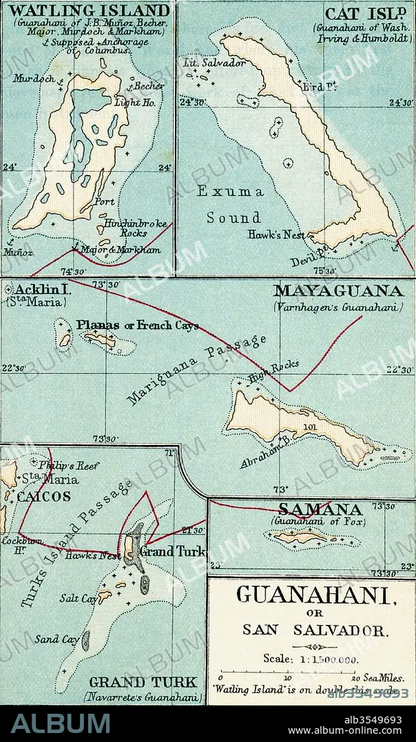
Map of Guanahani or San Salvador showing Watling Island where Christopher Columbus made landfall in 1492
| Compartir |
|---|
 Pinterest Pinterest |
 Twitter Twitter |
 Facebook Facebook |
 Copiar enlace Copiar enlace |
 Email Email |
|
Añadir a otro lightbox |
|
Añadir a otro lightbox |


¿Ya tienes cuenta? Iniciar sesión
¿No tienes cuenta? Regístrate
Compra esta imagen.
Selecciona el uso:

Título: Map of Guanahani or San Salvador showing Watling Island where Christopher Columbus made landfall in 1492
Descripción: Ver traducción automática
Map of Guanahani or San Salvador showing Watling Island where Christopher Columbus made landfall in 1492. From the book Life of Christopher Columbus by Clements R. Markham published 1892.
Map of Guanahani or San Salvador showing Watling Island where Christopher Columbus made landfall in 1492. From the book Life of Christopher Columbus by Clements R. Markham published 1892.
Crédito: Album / Universal Images Group / Universal History Archive
Autorizaciones: ? Cesión de modelo: No - ? Cesión de propiedad: No
¿Preguntas relacionadas con los derechos?
¿Preguntas relacionadas con los derechos?
Tamaño imagen: 3220 × 5457 px | 50.3 MB
Tamaño impresión: 27.3 × 46.2 cm | 1267.7 × 2148.4 in (300 dpi)
