alb8368762
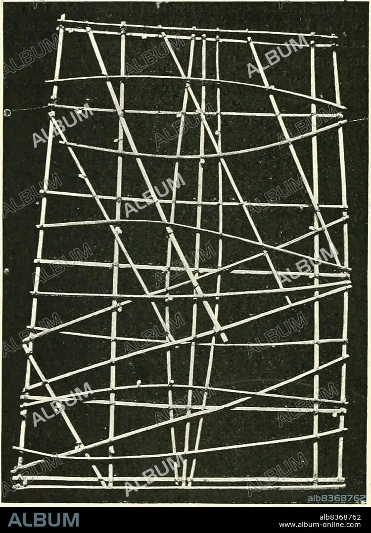
Marshall Islands: Stick chart from the 'Handbook to the Ethnographical Collections' by Thomas Athol Joyce (1878-1942),1910
| Compartir |
|---|
 Pinterest Pinterest |
 Twitter Twitter |
 Facebook Facebook |
 Copiar enlace Copiar enlace |
 Email Email |
|
Añadir a otro lightbox |
|
Añadir a otro lightbox |


¿Ya tienes cuenta? Iniciar sesión
¿No tienes cuenta? Regístrate
Compra esta imagen.
Selecciona el uso:

Título: Marshall Islands: Stick chart from the 'Handbook to the Ethnographical Collections' by Thomas Athol Joyce (1878-1942),1910
Descripción: Ver traducción automática
Marshall Islands stick charts were made by native Marshallese sailors to navigate the Pacific Ocean by canoe. The charts were a representation of major oceanic swell patterns and showed the ways the islands disrupted these patterns. Stick charts were primarily made from tied together coconut fronds, with island locations displayed on the charts with shells.
. Each chart was unique and interpretative that most could only be deciphered by the individual navigator who had made it. Stick charts came to an end after World War II, once new electronic technologies allowed for easier travel among islands and led to the decline of canoe use.
Crédito: Album / Universal Images Group / Pictures From History
Autorizaciones: ? Cesión de modelo: No - ? Cesión de propiedad: No
¿Preguntas relacionadas con los derechos?
¿Preguntas relacionadas con los derechos?
Tamaño imagen: 3600 × 4914 px | 50.6 MB
Tamaño impresión: 30.5 × 41.6 cm | 1417.3 × 1934.6 in (300 dpi)
Palabras clave: 1910 • CARTOGRAFIA • GRAFICO • ISLA • ISLAS • MAPA • MAPAS • MICRONESIA • NAVEGACION • OCEANIA
