alb9356864
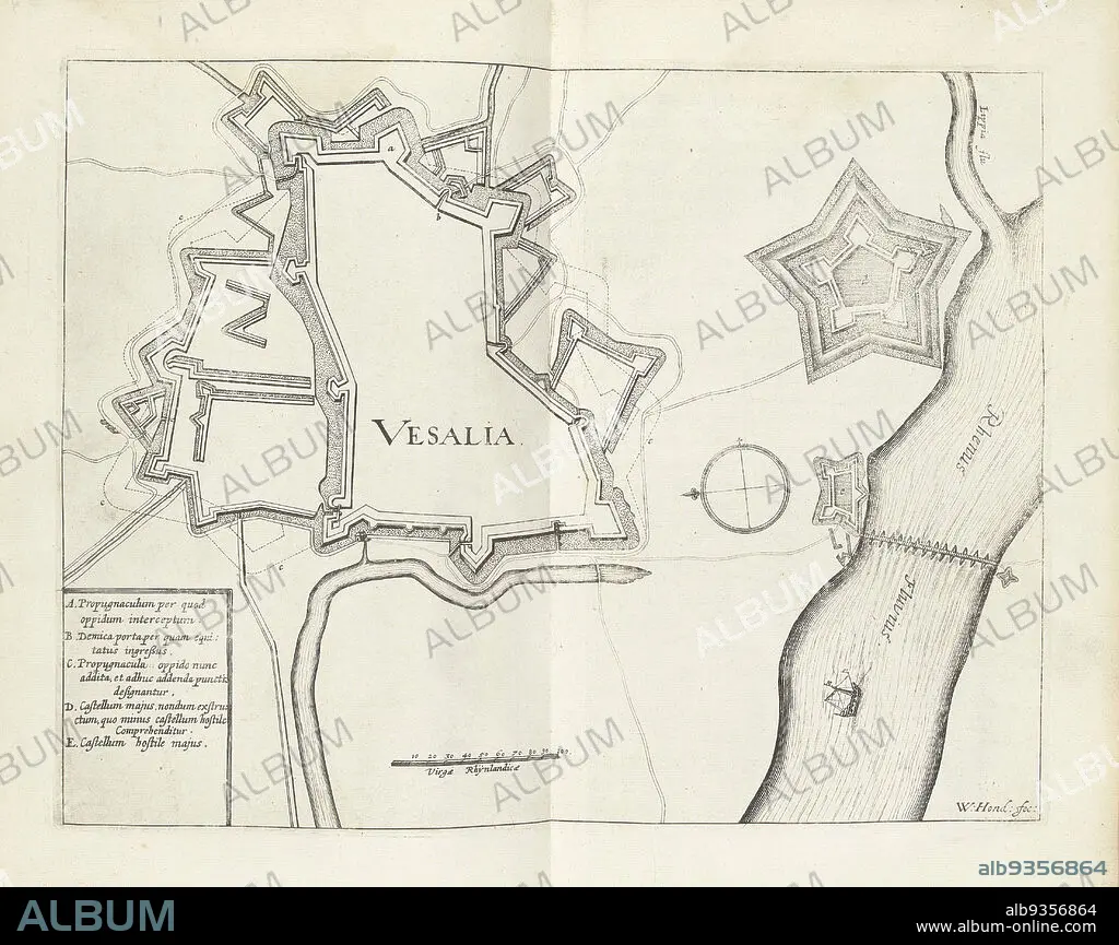
Map of Wesel, 1629, Vesalia (title on object), Map of the city of Wesel, taken by the State army under Frederick Henry, August 19, 1629., print maker: Willem Hondius (mentioned on object), Northern Netherlands, 1629 - 1631, paper, engraving, height 236 mm × width 305 mm.
| Compartir |
|---|
 Pinterest Pinterest |
 Twitter Twitter |
 Facebook Facebook |
 Copiar enlace Copiar enlace |
 Email Email |
|
Añadir a otro lightbox |
|
Añadir a otro lightbox |


¿Ya tienes cuenta? Iniciar sesión
¿No tienes cuenta? Regístrate
Compra esta imagen

Descripción:
Ver traducción automática
Map of Wesel, 1629, Vesalia (title on object), Map of the city of Wesel, taken by the State army under Frederick Henry, August 19, 1629., print maker: Willem Hondius (mentioned on object), Northern Netherlands, 1629 - 1631, paper, engraving, height 236 mm × width 305 mm
Crédito:
Album / quintlox
Autorizaciones:
Modelo: No - Propiedad: No
¿Preguntas relacionadas con los derechos?
¿Preguntas relacionadas con los derechos?
Tamaño imagen:
4419 x 3502 px | 44.3 MB
Tamaño impresión:
37.4 x 29.7 cm | 14.7 x 11.7 in (300 dpi)
