alb4055835
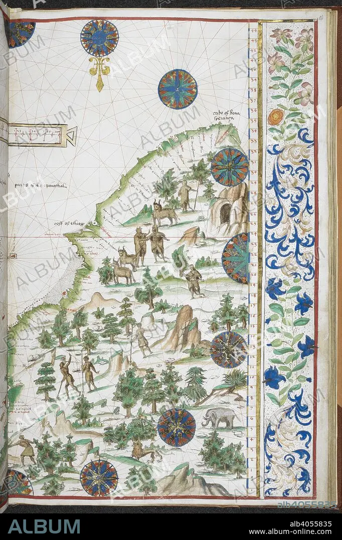
Chart of the eastern coast of Africa. Jean Rotz, Boke of Idrography (The 'Rotz Atlas'). c 1535-1542. Source: Royal MS 20 E IX f.14. Language: French & English.
| Compartir |
|---|
 Pinterest Pinterest |
 Twitter Twitter |
 Facebook Facebook |
 Copiar enlace Copiar enlace |
 Email Email |
|
Añadir a otro lightbox |
|
Añadir a otro lightbox |


¿Ya tienes cuenta? Iniciar sesión
¿No tienes cuenta? Regístrate
Compra esta imagen.
Selecciona el uso:

Autor: JEAN ROTZ
Descripción: Ver traducción automática
Chart of the eastern coast of Africa. Jean Rotz, Boke of Idrography (The 'Rotz Atlas'). c 1535-1542. Source: Royal MS 20 E IX f.14. Language: French & English.
Chart of the eastern coast of Africa. Jean Rotz, Boke of Idrography (The 'Rotz Atlas'). c 1535-1542. Source: Royal MS 20 E IX f.14. Language: French & English.
Crédito: Album / British Library
Autorizaciones: ? Cesión de modelo: No - ? Cesión de propiedad: No
¿Preguntas relacionadas con los derechos?
¿Preguntas relacionadas con los derechos?
Tamaño imagen: 4440 × 6665 px | 84.7 MB
Tamaño impresión: 37.6 × 56.4 cm | 1748.0 × 2624.0 in (300 dpi)
Palabras clave: AFRICA • CARTOGRAFIA • CARTOGRAFICO • COLOR • COLORES • COLORIDO • COSTA • DOCUMENTO • GENTE • LITORAL • MANUSCRITO • MAPA • MAPAS • NACIONALIDAD • ORIGEN ÉTNICO • ORILLA DEL MAR • PEOPLE • PERSONAS • ROTZ, JEAN • S. XVI • SIGLO XVI
