alb3980258
Map of London, 1560. Artist: George Vertue
| Compartir |
|---|
 Pinterest Pinterest |
 Twitter Twitter |
 Facebook Facebook |
 Copiar enlace Copiar enlace |
 Email Email |
|
Añadir a otro lightbox |
|
Añadir a otro lightbox |


¿Ya tienes cuenta? Iniciar sesión
¿No tienes cuenta? Regístrate
Compra esta imagen.
Selecciona el uso:

Título: Map of London, 1560. Artist: George Vertue
Descripción: Ver traducción automática
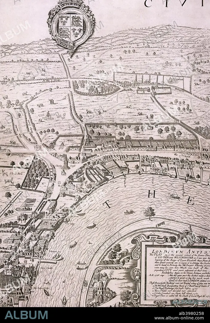
Map of London in the year 1560; showing the area between Westminster and the Strand, with Lambeth to the south of the River Thames and the Tudor royal arms at the top.
Map of London in the year 1560; showing the area between Westminster and the Strand, with Lambeth to the south of the River Thames and the Tudor royal arms at the top.
Personas: GEORGE VERTUE
Crédito: Album / The London Archives (City of London)/Heritage Images
Autorizaciones: ? Cesión de modelo: No - ? Cesión de propiedad: No
¿Preguntas relacionadas con los derechos?
¿Preguntas relacionadas con los derechos?
Tamaño imagen: 3461 × 5047 px | 50.0 MB
Tamaño impresión: 29.3 × 42.7 cm | 1362.6 × 1987.0 in (300 dpi)
Palabras clave: BLANCO Y NEGRO • CIUDAD DE LONDRES • CIUDAD DE WESTMINSTER • ESCUDO DE ARMAS • GENTE • GEOGRAFIA • GEORGE VERTUE • GEORGE • GRABADO • GUILDHALL LIBRARY & ART GALLERY • INGLATERRA • LONDRES • MAPA • MONOCHROME • MONOCROMO • REAL (REALEZA) • REALEZA • RIO TAMESIS • RIO • S. XVI • SIGLO XVI • SIGLO • TAMESIS • TUDOR • WESTMINSTER
