alb3548663
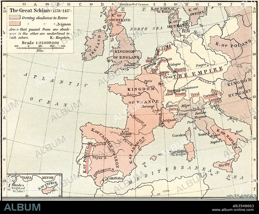
Map of The Western Schism, or Papal or Great Schism, 1378-1417, showing allegiance of European countries
| Compartir |
|---|
 Pinterest Pinterest |
 Twitter Twitter |
 Facebook Facebook |
 Copiar enlace Copiar enlace |
 Email Email |
|
Añadir a otro lightbox |
|
Añadir a otro lightbox |


¿Ya tienes cuenta? Iniciar sesión
¿No tienes cuenta? Regístrate
Compra esta imagen.
Selecciona el uso:

Título:
Map of The Western Schism, or Papal or Great Schism, 1378-1417, showing allegiance of European countries
Descripción:
Ver traducción automática
Map of The Western Schism, or Papal or Great Schism, 1378 - 1417, showing allegiance of European countries. From Historical Atlas, published 1923.
Crédito:
Album / Universal Images Group / Universal History Archive
Autorizaciones:
Modelo: No - Propiedad: No
¿Preguntas relacionadas con los derechos?
¿Preguntas relacionadas con los derechos?
Tamaño imagen:
4883 x 3783 px | 52.8 MB
Tamaño impresión:
41.3 x 32.0 cm | 16.3 x 12.6 in (300 dpi)
