alb9387288
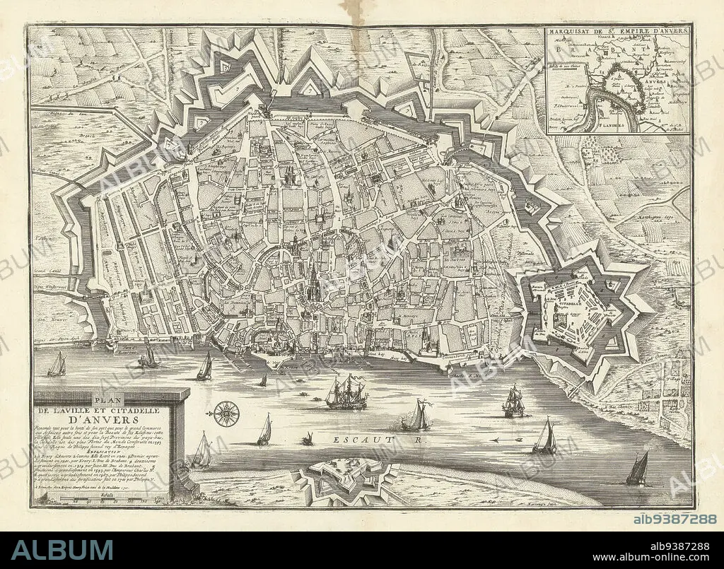
Map of Antwerp, 1711, Plan de la ville et citadelle d'Anvers (title on object), Map of Antwerp, 1711. Top right an inset with a map of the larger area. Part of a bundled collection of plans of battles and cities famous in the War of the Spanish Succession., print maker: Jacobus Harrewijn (mentioned on object), publisher: Eugene Henry Fricx (mentioned on object), Brussels, 1711, paper, etching, height 395 mm × width 535 mm.
| Compartir |
|---|
 Pinterest Pinterest |
 Twitter Twitter |
 Facebook Facebook |
 Copiar enlace Copiar enlace |
 Email Email |
|
Añadir a otro lightbox |
|
Añadir a otro lightbox |


¿Ya tienes cuenta? Iniciar sesión
¿No tienes cuenta? Regístrate
Compra esta imagen.
Selecciona el uso:

Descripción:
Ver traducción automática
Map of Antwerp, 1711, Plan de la ville et citadelle d'Anvers (title on object), Map of Antwerp, 1711. Top right an inset with a map of the larger area. Part of a bundled collection of plans of battles and cities famous in the War of the Spanish Succession., print maker: Jacobus Harrewijn (mentioned on object), publisher: Eugene Henry Fricx (mentioned on object), Brussels, 1711, paper, etching, height 395 mm × width 535 mm
Personas:
Crédito:
Album / quintlox
Autorizaciones:
Modelo: No - Propiedad: No
¿Preguntas relacionadas con los derechos?
¿Preguntas relacionadas con los derechos?
Tamaño imagen:
5508 x 4044 px | 63.7 MB
Tamaño impresión:
46.6 x 34.2 cm | 18.4 x 13.5 in (300 dpi)
