alb3178090
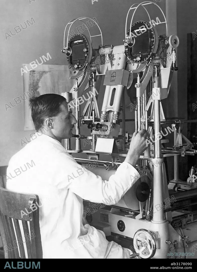
Washington, D. C.: October 13, 1927 Heinz Gruner of the U. S. Geological Survey doing experimental trials of an aerocartograph to do topographic mapping with aerial images © Underwood Archives / The Image Works
| Compartir |
|---|
 Pinterest Pinterest |
 Twitter Twitter |
 Facebook Facebook |
 Copiar enlace Copiar enlace |
 Email Email |
|
Añadir a otro lightbox |
|
Añadir a otro lightbox |


¿Ya tienes cuenta? Iniciar sesión
¿No tienes cuenta? Regístrate
Compra esta imagen.
Selecciona el uso:

Título: Washington, D. C.: October 13, 1927 Heinz Gruner of the U. S. Geological Survey doing experimental trials of an aerocartograph to do topographic mapping with aerial images © Underwood Archives / The Image Works
Descripción: Ver traducción automática
Washington, D.C.: October 13, 1927 Heinz Gruner of the U.S. Geological Survey doing experimental trials of an aerocartograph to do topographic mapping with aerial images © Underwood Archives / The Image Works
Washington, D.C.: October 13, 1927 Heinz Gruner of the U.S. Geological Survey doing experimental trials of an aerocartograph to do topographic mapping with aerial images © Underwood Archives / The Image Works
Crédito: Album / Universal Images Group
Autorizaciones: ? Cesión de modelo: No - ? Cesión de propiedad: No
¿Preguntas relacionadas con los derechos?
¿Preguntas relacionadas con los derechos?
Tamaño imagen: 3894 × 5100 px | 56.8 MB
Tamaño impresión: 33.0 × 43.2 cm | 1533.1 × 2007.9 in (300 dpi)
Palabras clave: 1927 • ADULTO MEDIO • ADULTO • ALCOHOL • ALIMENTO • ALIMENTOS • ALUMNO • ANALIZAR • ASIGNACIÓN • AUTOMOVIL • AÑOS 20 • BEBER • BEBIDA • CARTOGRAFIA • CÁTEDRA • COMIDA • CULTURA • DESCUBRIMIENTO • EDUCACION • EE. UU • EE. UU. • EEUU / ESTADOS UNIDOS • EEUU • ENCUESTA • ENSEÑANZA • ESTADOS UNIDOS DE AMERICA • ESTADOS UNIDOS • ESTUDIO • EXAMINAR • EXPERIENCIA • FABRICA • FÁBRICAS • FORMACION • HABILIDAD • HISTORICO • HOMBRE • INDUSTRIA • INDUSTRIAS • INGENIERO • INSTRUCCION • INTERIOR • INVESTIGACION • JOB • LOOKING • MAQUINA • MAQUINARIA • MASCULINA • MASCULINO • MASCULINOS • OBRERA • OCUPACION • PEDAGOGIA • PERSONA, UNA • PUESTOS • RETRATO DE HOMBRE • REVISAR • RUEDA • SEATED • SEDENTE • SENTADO • SENTADOS • SILLA • SILLAS • SITTING • SOLA PERSONA • SÓLO UNA PERSONA • TABURETE • TECNOLOGÍA • TRABAJO • TRANSPORTE • U. S. A. • UNA PERSONA • USA • VERTICAL • VINTAGE • WASHINGTON • WHEEL
