alb2603218
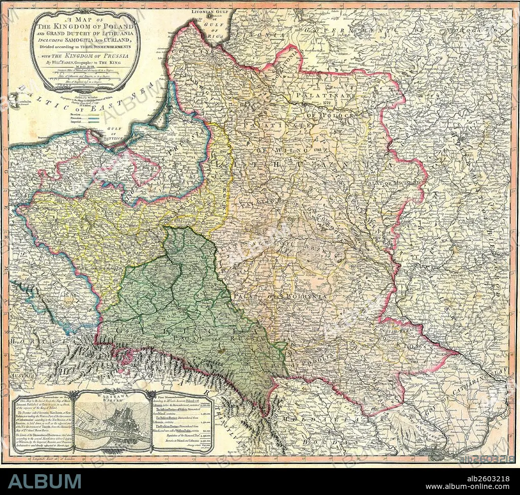
Map showing the partition of the Kingdom of Poland and the Grand Duchy of Lithuania.
| Compartir |
|---|
 Pinterest Pinterest |
 Twitter Twitter |
 Facebook Facebook |
 Copiar enlace Copiar enlace |
 Email Email |
|
Añadir a otro lightbox |
|
Añadir a otro lightbox |


¿Ya tienes cuenta? Iniciar sesión
¿No tienes cuenta? Regístrate
Compra esta imagen

Título:
Map showing the partition of the Kingdom of Poland and the Grand Duchy of Lithuania.
Descripción:
Ver traducción automática
Map showing the partition of the Kingdom of Poland and the Grand Duchy of Lithuania, 1799.
Crédito:
Album / Universal Images Group / Universal History Archive
Autorizaciones:
Modelo: No - Propiedad: No
¿Preguntas relacionadas con los derechos?
¿Preguntas relacionadas con los derechos?
Tamaño imagen:
4827 x 4344 px | 60.0 MB
Tamaño impresión:
40.9 x 36.8 cm | 16.1 x 14.5 in (300 dpi)
