alb4059428
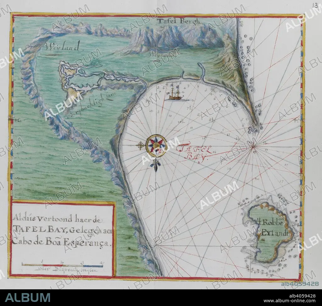
Map of the Cape of Good Hope. Table Bay, South Africa. DUTCH PORTOLANO, containing forty-nine coloured maps and views. 17th century. Source: Add. 34184, f.12.
| Compartir |
|---|
 Pinterest Pinterest |
 Twitter Twitter |
 Facebook Facebook |
 Copiar enlace Copiar enlace |
 Email Email |
|
Añadir a otro lightbox |
|
Añadir a otro lightbox |


¿Ya tienes cuenta? Iniciar sesión
¿No tienes cuenta? Regístrate
Compra esta imagen.
Selecciona el uso:

Descripción: Ver traducción automática
Map of the Cape of Good Hope. Table Bay, South Africa. DUTCH PORTOLANO, containing forty-nine coloured maps and views. 17th century. Source: Add. 34184, f.12.
Map of the Cape of Good Hope. Table Bay, South Africa. DUTCH PORTOLANO, containing forty-nine coloured maps and views. 17th century. Source: Add. 34184, f.12.
Crédito: Album / British Library
Autorizaciones: ? Cesión de modelo: No - ? Cesión de propiedad: No
¿Preguntas relacionadas con los derechos?
¿Preguntas relacionadas con los derechos?
Tamaño imagen: 4291 × 3857 px | 47.4 MB
Tamaño impresión: 36.3 × 32.7 cm | 1689.4 × 1518.5 in (300 dpi)
Palabras clave: AFRICA DEL SUR • AFRICA • CABO DE BUENA ESPERANZA • CARTOGRAFIA • CARTOGRAFICO • GRAFICO • MAPA • MAPAS • SIGLO XVII • SUDÁFRICA
