alb6092268
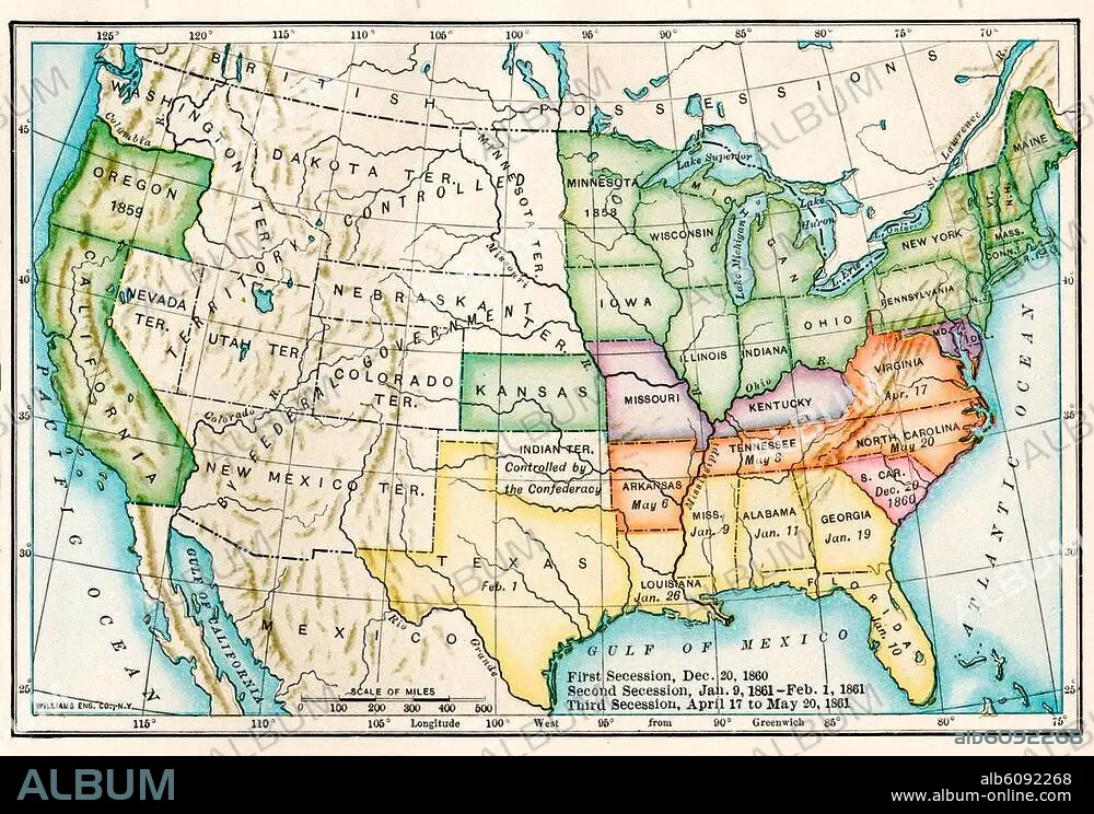
US map showing seceding states by date,
| Compartir |
|---|
 Pinterest Pinterest |
 Twitter Twitter |
 Facebook Facebook |
 Copiar enlace Copiar enlace |
 Email Email |
|
Añadir a otro lightbox |
|
Añadir a otro lightbox |


¿Ya tienes cuenta? Iniciar sesión
¿No tienes cuenta? Regístrate
Compra esta imagen.
Selecciona el uso:

Título: US map showing seceding states by date,
Descripción: Ver traducción automática
US map showing seceding states by date, American Civil War, 1860 and 1861. Printed color lithograph 19th century
US map showing seceding states by date, American Civil War, 1860 and 1861. Printed color lithograph 19th century
Crédito: Album / akg/North Wind Picture Archives
Autorizaciones: ? Cesión de modelo: No - ? Cesión de propiedad: No
¿Preguntas relacionadas con los derechos?
¿Preguntas relacionadas con los derechos?
Tamaño imagen: 3364 × 2326 px | 22.4 MB
Tamaño impresión: 28.5 × 19.7 cm | 1324.4 × 915.7 in (300 dpi)
Palabras clave: ART • ARTE • ARTES • CONFLICTO BELICO • EE. UU • EE. UU. • EEUU • ESTADOS UNIDOS DE AMERICA • ESTADOS UNIDOS USA EUA EEUU • ESTADOS UNIDOS • FOTOGRAFIA • GUERRA CIVIL • GUERRA • GUERRAS • HISTORIA USA • HISTORIA • ILUSTRACION • ILUSTRACIONES • MAPA • MAPAS • NORTEAMERICA • OBRA DE ARTE • S. XIX • SIGLO XIX • SUR • U. S. A. • USA • WAR
