alb3799799
Medieval World Map
| Compartir |
|---|
 Pinterest Pinterest |
 Twitter Twitter |
 Facebook Facebook |
 Copiar enlace Copiar enlace |
 Email Email |
|
Añadir a otro lightbox |
|
Añadir a otro lightbox |


¿Ya tienes cuenta? Iniciar sesión
¿No tienes cuenta? Regístrate
Compra esta imagen

Título:
Medieval World Map
Descripción:
Ver traducción automática
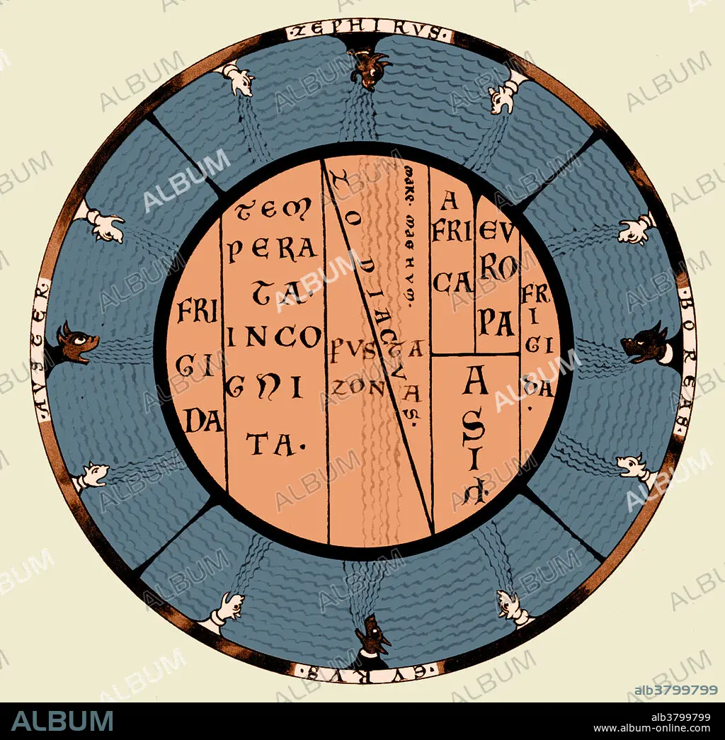
T and O (orbis terrarum) map of the Medieval world by Macrobius Ambrosius, showing the climatic zones and the Mare Magnum, the Great Ocean which was thought to separate the inhabited world from an unknown continent in the south.
Crédito:
Album / Science Source
Autorizaciones:
Modelo: No - Propiedad: No
¿Preguntas relacionadas con los derechos?
¿Preguntas relacionadas con los derechos?
Tamaño imagen:
4200 x 4068 px | 48.9 MB
Tamaño impresión:
35.6 x 34.4 cm | 14.0 x 13.6 in (300 dpi)
Palabras clave:
ANTIGUO • ARTE • CARTOGRAFIA • DIBUJO • GRABADO • HISTORIA • HISTORICO • ILUSTRACION • IMPRESION • MAPA • MEDIA • MEDIEVAL • MIDDLE • OBRA DE ARTE
