alb3545996
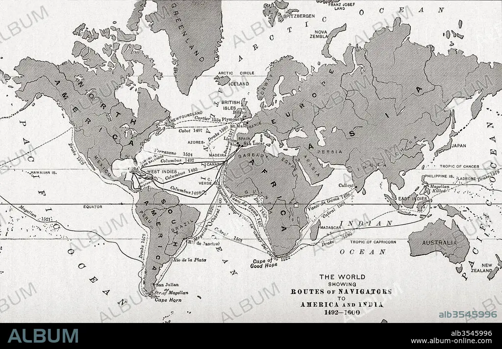
Map of the world showing the routes of navigators to America and India from 1492-1600
| Compartir |
|---|
 Pinterest Pinterest |
 Twitter Twitter |
 Facebook Facebook |
 Copiar enlace Copiar enlace |
 Email Email |
|
Añadir a otro lightbox |
|
Añadir a otro lightbox |


¿Ya tienes cuenta? Iniciar sesión
¿No tienes cuenta? Regístrate
Compra esta imagen.
Selecciona el uso:

Título:
Map of the world showing the routes of navigators to America and India from 1492-1600
Descripción:
Ver traducción automática
Map of the world showing the routes of navigators to America and India from 1492-1600. From The History of Our Country, published 1899
Crédito:
Album / Universal Images Group / Universal History Archive
Autorizaciones:
Tamaño imagen:
5220 x 3355 px | 50.1 MB
Tamaño impresión:
44.2 x 28.4 cm | 17.4 x 11.2 in (300 dpi)
Palabras clave:
AMERICA • AMERICAN • AMERICANA • AMERICANO • AMERICANOS • CONTINENTE AMERICANO • DESCUBRIMIENTO • EEUU / ESTADOS UNIDOS • ESTADOS UNIDOS • ESTADOUNIDENSE • ESTADOUNIDENSES • EXPLORACION • GEOGRAFIA • GEOGRAFICO • GRAFICO • INDIA • MAPA • MUNDO • NAVEGACION • NORTEAMERICANA • NORTEAMERICANAS • NORTEAMERICANOS • PAÍS • PAISES • PISTA • RUTAS • S. XV • S. XVI • SIGLO XV • SIGLO XVI • SIGLO
