alb3988176
Map of Aldgate Ward, City of London, 1739. Artist: RW Seale
| Compartir |
|---|
 Pinterest Pinterest |
 Twitter Twitter |
 Facebook Facebook |
 Copiar enlace Copiar enlace |
 Email Email |
|
Añadir a otro lightbox |
|
Añadir a otro lightbox |


¿Ya tienes cuenta? Iniciar sesión
¿No tienes cuenta? Regístrate
Compra esta imagen.
Selecciona el uso:

Título: Map of Aldgate Ward, City of London, 1739. Artist: RW Seale
Descripción: Ver traducción automática
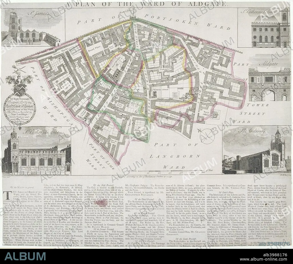
Map of Aldgate Ward, City of London, 1739. With images in the margins of Aldgate and four ward churches: St James, Duke Street, St Katherine Cree, St Katherine Coleman and St Andrew Undershaft. Below is a description of the ward.
Map of Aldgate Ward, City of London, 1739. With images in the margins of Aldgate and four ward churches: St James, Duke Street, St Katherine Cree, St Katherine Coleman and St Andrew Undershaft. Below is a description of the ward.
Personas: JACOB
Crédito: Album / The London Archives (City of London)/Heritage Images
Autorizaciones: ? Cesión de modelo: No - ? Cesión de propiedad: No
¿Preguntas relacionadas con los derechos?
¿Preguntas relacionadas con los derechos?
Tamaño imagen: 2718 × 2310 px | 18.0 MB
Tamaño impresión: 23.0 × 19.6 cm | 1070.1 × 909.4 in (300 dpi)
Palabras clave: ARQUITECTURA • BRITANICO • CHRISTIANITY • CHURCH • CIUDAD DE LONDRES • COLOR • COLORIDO • CRISTIANDAD • CRISTIANISMO • CRISTIANO • CRISTIANSMO • EDIFICIO • EDIFICIOS • EXTERIOR • FUERA • GRABADO • GRAN BRETAÑA • GUILDHALL LIBRARY & ART GALLERY • IGLESIA • INGLATERRA • INGLES • JACOB • MAPA • PAÍS • PORTON • RELIGION • RELIGIOSO • S. XVIII • SIGLO XVIII • SIGLO
