alb12105471
Map of Englewood
| Compartir |
|---|
 Pinterest Pinterest |
 Twitter Twitter |
 Facebook Facebook |
 Copiar enlace Copiar enlace |
 Email Email |
|
Añadir a otro lightbox |
|
Añadir a otro lightbox |


¿Ya tienes cuenta? Iniciar sesión
¿No tienes cuenta? Regístrate
Compra esta imagen.
Selecciona el uso:

Título: Map of Englewood
Descripción: Ver traducción automática
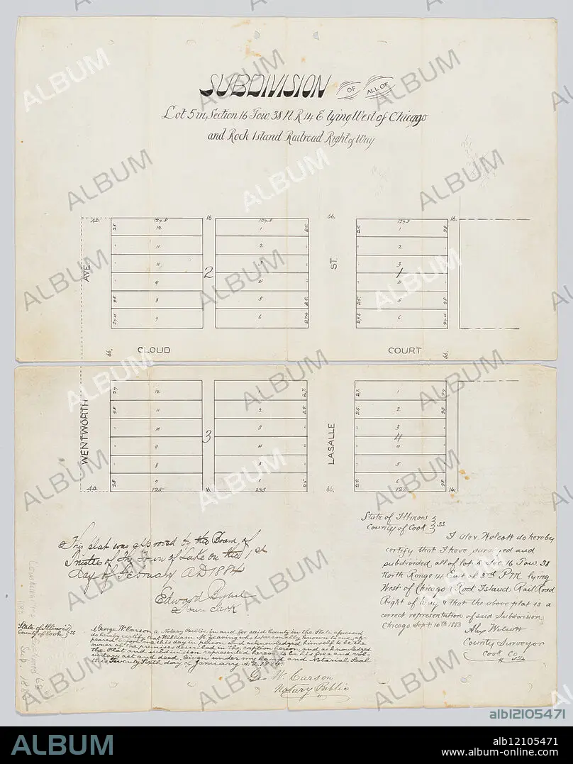
Map of Englewood, Chicago, Illinois, 1883. View of Wentworth Avenue and LaSalle Street immediately north and south of Cloud Court. Handwritten record of approval by Board of Trustees of Town of Lake by Edward Bybel, town clerk, February 1, 1884; handwritten certification of accuracy by Alex Wolcott, county surveyor, September 10, 1883; handwritten certification of William M. Zearing as owner of land by Geo. W. Carson, notary public, January 26, 1884.
Map of Englewood, Chicago, Illinois, 1883. View of Wentworth Avenue and LaSalle Street immediately north and south of Cloud Court. Handwritten record of approval by Board of Trustees of Town of Lake by Edward Bybel, town clerk, February 1, 1884; handwritten certification of accuracy by Alex Wolcott, county surveyor, September 10, 1883; handwritten certification of William M. Zearing as owner of land by Geo. W. Carson, notary public, January 26, 1884.
Crédito: Album / Chicago History Museum / TopFoto
Autorizaciones: ? Cesión de modelo: No - ? Cesión de propiedad: No
¿Preguntas relacionadas con los derechos?
¿Preguntas relacionadas con los derechos?
Tamaño imagen: 4502 × 5706 px | 73.5 MB
Tamaño impresión: 38.1 × 48.3 cm | 1772.4 × 2246.5 in (300 dpi)
Palabras clave: BARRIOS
