alb3810254
Africa Map Areas of Slave Trade, 1850
| Compartir |
|---|
 Pinterest Pinterest |
 Twitter Twitter |
 Facebook Facebook |
 Copiar enlace Copiar enlace |
 Email Email |
|
Añadir a otro lightbox |
|
Añadir a otro lightbox |


¿Ya tienes cuenta? Iniciar sesión
¿No tienes cuenta? Regístrate
Compra esta imagen.
Selecciona el uso:

Título: Africa Map Areas of Slave Trade, 1850
Descripción: Ver traducción automática
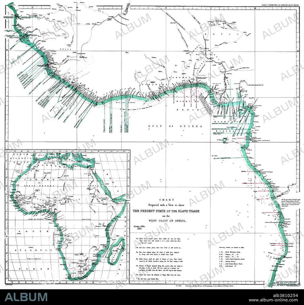
"The Present State of the Slave Trade on the West Coast of Africa," 1850. A map of the west coast of Africa showing areas of slave trade during the early 19th century. The map denotes areas of missionary work and capture of slave ships by British vessels. Inset of African continent. Created by John Arrowsmith of the Select Committee on African Slave Trade.
"The Present State of the Slave Trade on the West Coast of Africa," 1850. A map of the west coast of Africa showing areas of slave trade during the early 19th century. The map denotes areas of missionary work and capture of slave ships by British vessels. Inset of African continent. Created by John Arrowsmith of the Select Committee on African Slave Trade.
Crédito: Album / Science Source / Smithsonian Libraries
Autorizaciones: ? Cesión de modelo: No - ? Cesión de propiedad: No
¿Preguntas relacionadas con los derechos?
¿Preguntas relacionadas con los derechos?
Tamaño imagen: 4170 × 3971 px | 47.4 MB
Tamaño impresión: 35.3 × 33.6 cm | 1641.7 × 1563.4 in (300 dpi)
Palabras clave: 1800S • 1850 • AFRICA • AFRICANO • BRITANICO • COLONIALISMO • COMERCIO DE ESCLAVOS • CONTINENTE • COSTA OESTE • ESCLAVISMO • ESCLAVITUD • HISTORIA • HISTORICO • IMPERIALISMO • LITORAL • MAPA ANTIGUO • MAPA • REGION • SIGLO XIX • TRAFICO DE ESCLAVOS
