alb1962068
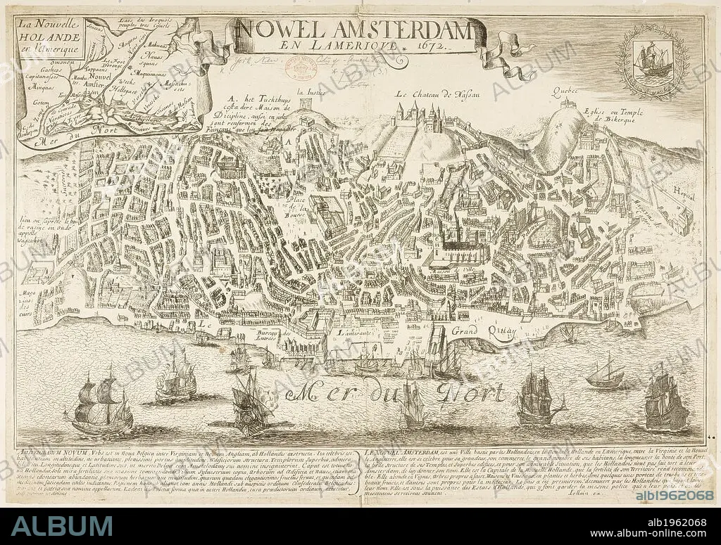
Map of New Amsterdam (New York) in 1672 and then in 1729, showing 88 years of growth. . Nowel Amsterdam 1729. New York, USA. Actual Map and Comparative Plans showing 88 years growth of the City of New York, by D. Longworth. (Plan of New York in 1729, surveyed by I. Lyne). Publisher/year :New York, 1817. Source: Maps.73953 (3).
| Compartir |
|---|
 Pinterest Pinterest |
 Twitter Twitter |
 Facebook Facebook |
 Copiar enlace Copiar enlace |
 Email Email |
|
Añadir a otro lightbox |
|
Añadir a otro lightbox |


¿Ya tienes cuenta? Iniciar sesión
¿No tienes cuenta? Regístrate
Compra esta imagen.
Selecciona el uso:

Descripción:
Ver traducción automática
Map of New Amsterdam (New York) in 1672 and then in 1729, showing 88 years of growth. . Nowel Amsterdam 1729. New York, USA. Actual Map and Comparative Plans showing 88 years growth of the City of New York, by D. Longworth. (Plan of New York in 1729, surveyed by I. Lyne). Publisher/year :New York, 1817. Source: Maps.73953 (3).
Crédito:
Album / British Library
Autorizaciones:
Tamaño imagen:
7144 x 5038 px | 103.0 MB
Tamaño impresión:
60.5 x 42.7 cm | 23.8 x 16.8 in (300 dpi)
Palabras clave:
AMÉRICA DEL NORTE • AMERICA SEPTENTRIONAL • CARTOGRAFIA • CARTOGRAFICO • CIUDAD • EE. UU • EE. UU. • EEUU / ESTADOS UNIDOS • EEUU • ESTADOS UNIDOS DE AMERICA • ESTADOS UNIDOS • ESTILO Y PERIODO • MAPA • MAPAS • NEOYORQUINA • NEOYORQUINOS • NEW YORK • NORTEAMERICA • NUEVA YORK CIUDAD • NUEVA YORK • S. XVIII • SIGLO XVIII • U. S. A. • USA
