alb9831162
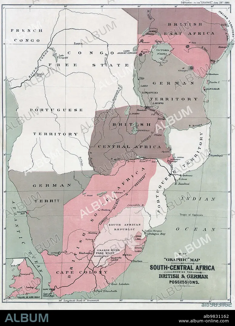
Map of south-Central Africa showing British and German possessions in the 1890s. After a map published in the June 25th, 1890 edition of The Graphic. The inset map, lower left, shows England on the same scale as the African map.
| Compartir |
|---|
 Pinterest Pinterest |
 Twitter Twitter |
 Facebook Facebook |
 Copiar enlace Copiar enlace |
 Email Email |
|
Añadir a otro lightbox |
|
Añadir a otro lightbox |


¿Ya tienes cuenta? Iniciar sesión
¿No tienes cuenta? Regístrate
Compra esta imagen.
Selecciona el uso:

Descripción: Ver traducción automática
Map of south-Central Africa showing British and German possessions in the 1890s. After a map published in the June 25th, 1890 edition of The Graphic. The inset map, lower left, shows England on the same scale as the African map.
Map of south-Central Africa showing British and German possessions in the 1890s. After a map published in the June 25th, 1890 edition of The Graphic. The inset map, lower left, shows England on the same scale as the African map.
Crédito: Album / Ken Welsh/Universal History Archive/Universal Images Group
Autorizaciones: ? Cesión de modelo: No - ? Cesión de propiedad: No
¿Preguntas relacionadas con los derechos?
¿Preguntas relacionadas con los derechos?
Tamaño imagen: 4029 × 5315 px | 61.3 MB
Tamaño impresión: 34.1 × 45.0 cm | 1586.2 × 2092.5 in (300 dpi)
Palabras clave: AFRICA • ALEMAN • ALEMANA • ALEMANES • ALEMANIA • ARCHIVO • BIENES • BLANCO • BRITANICA • BRITANICO • BRITANICOS • CARTOGRAFIA • COLONIA (TERRITORIO) • COLONIALISMO • DEPENDENCIA • DOCUMENTO • FICHERO • GEOGRAFIA • GEOGRAFICO • GRAN BRETAÑA • HISTORIA • HISTORICO • ILUSTRACION • ILUSTRACIONES • INGLATERRA • INGLES • INGLESA • INGLESES • NEGRO • PAÍS • POSESION • REINO UNIDO • S. XIX • SIGLO XIX • TERRITORIO • TERRITORIOS • WHITE
