alb1654527
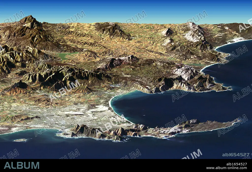
Cape Town and Cape of Good Hope, South Africa, in foreground of perspective view generated from Landsat satellite image and elevation data from the Shuttle Radar Topography Mission (SRTM). Credit NASA. Science Earth Geology.
| Compartir |
|---|
 Pinterest Pinterest |
 Twitter Twitter |
 Facebook Facebook |
 Copiar enlace Copiar enlace |
 Email Email |
|
Añadir a otro lightbox |
|
Añadir a otro lightbox |


¿Ya tienes cuenta? Iniciar sesión
¿No tienes cuenta? Regístrate
Compra esta imagen.
Selecciona el uso:

Descripción: Ver traducción automática
Cape Town and Cape of Good Hope, South Africa, in foreground of perspective view generated from Landsat satellite image and elevation data from the Shuttle Radar Topography Mission (SRTM). Credit NASA. Science Earth Geology
Cape Town and Cape of Good Hope, South Africa, in foreground of perspective view generated from Landsat satellite image and elevation data from the Shuttle Radar Topography Mission (SRTM). Credit NASA. Science Earth Geology
Crédito: Album / Universal History Archive/Universal Images Group
Autorizaciones: ? Cesión de modelo: No - ? Cesión de propiedad: No
¿Preguntas relacionadas con los derechos?
¿Preguntas relacionadas con los derechos?
Tamaño imagen: 5291 × 3336 px | 50.5 MB
Tamaño impresión: 44.8 × 28.2 cm | 2083.1 × 1313.4 in (300 dpi)
Palabras clave: AFRICA • ASTRONOMIA • BUENA • CAPA • CIENCIA • CIENCIAS • CLIMA • CREDITO • ELEVACION • ESPERANZA • FOTOGRAFIA • GENERADOS • GEOLOGIA • IMAGEN • METEOROLOGÍA • METEREOLOGIA • METEREOLÓGICOS • MISION • NASA • PERSPECTIVA • PRIMER PLANO • PUEBLO • RADAR • SATELITE • SUR • TIERRA • TOPOGRAFIA • VISTA
