alb9203717
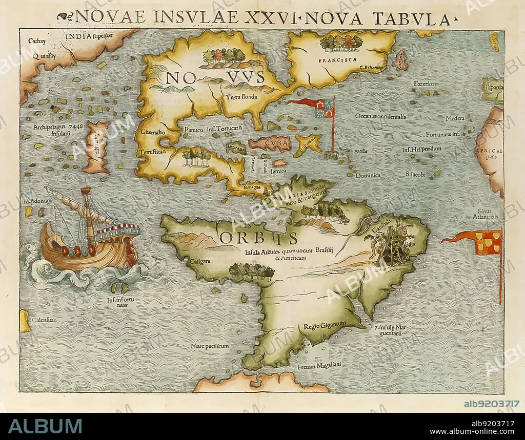
First Map of North and South America, 1544
| Compartir |
|---|
 Pinterest Pinterest |
 Twitter Twitter |
 Facebook Facebook |
 Copiar enlace Copiar enlace |
 Email Email |
|
Añadir a otro lightbox |
|
Añadir a otro lightbox |


¿Ya tienes cuenta? Iniciar sesión
¿No tienes cuenta? Regístrate
Compra esta imagen

Título:
First Map of North and South America, 1544
Descripción:
Ver traducción automática
Map of showing North and South America as the New World. The map first appeared in Sebastian Münster's Cosmographia in 1544. It is considered the first to show the entire continents of North and South America.
Crédito:
Album / Science Source
Autorizaciones:
Modelo: No - Propiedad: No
¿Preguntas relacionadas con los derechos?
¿Preguntas relacionadas con los derechos?
Tamaño imagen:
No disponible
Tamaño impresión:
No disponible
