alb3386844
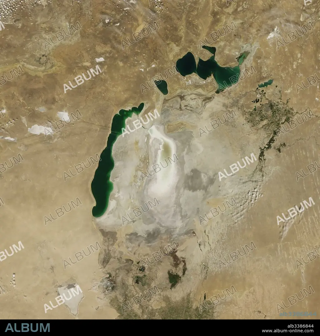
Satellite image of the shrinking of the Aral Sea taken in 2009.
| Compartir |
|---|
 Pinterest Pinterest |
 Twitter Twitter |
 Facebook Facebook |
 Copiar enlace Copiar enlace |
 Email Email |
|
Añadir a otro lightbox |
|
Añadir a otro lightbox |


¿Ya tienes cuenta? Iniciar sesión
¿No tienes cuenta? Regístrate
Compra esta imagen.
Selecciona el uso:

Título:
Satellite image of the shrinking of the Aral Sea taken in 2009.
Descripción:
Ver traducción automática
Satellite image of the shrinking of the Aral Sea taken in 2009. The Aral Sea, is a lake lying between Kazakhstan, in the north and Uzbekistan in the south. The name roughly translates as 'Sea of Islands', referring to over 1,100 islands that once dotted its waters; Formerly one of the four largest lakes in the world with an area of 68,000 km2 (26,300 sq mi), the Aral Sea has been steadily shrinking since the 1960s after the rivers that fed it were diverted by Soviet irrigation projects.
Crédito:
Album / Universal Images Group / Universal History Archive
Autorizaciones:
Modelo: No - Propiedad: No
¿Preguntas relacionadas con los derechos?
¿Preguntas relacionadas con los derechos?
Tamaño imagen:
4579 x 4579 px | 60.0 MB
Tamaño impresión:
38.8 x 38.8 cm | 15.3 x 15.3 in (300 dpi)
