alb4075494
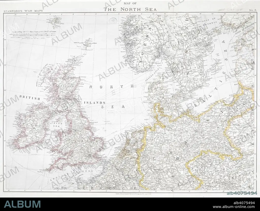
First World War map of the North Sea, 1914. Stanford's War Maps. No. 5. Map of the North Sea. Scale 50,8235 miles - 1 inch, or 1:3,220,177 of nature. London, 12 August 1914. Source: Maps.1035.(90) no.5.
| Compartir |
|---|
 Pinterest Pinterest |
 Twitter Twitter |
 Facebook Facebook |
 Copiar enlace Copiar enlace |
 Email Email |
|
Añadir a otro lightbox |
|
Añadir a otro lightbox |


¿Ya tienes cuenta? Iniciar sesión
¿No tienes cuenta? Regístrate
Compra esta imagen

Descripción:
Ver traducción automática
First World War map of the North Sea, 1914. Stanford's War Maps. No. 5. Map of the North Sea. Scale 50,8235 miles - 1 inch, or 1:3,220,177 of nature. London, 12 August 1914. Source: Maps.1035.(90) no.5.
Crédito:
Album / British Library
Autorizaciones:
Modelo: No - Propiedad: No
¿Preguntas relacionadas con los derechos?
¿Preguntas relacionadas con los derechos?
Tamaño imagen:
7886 x 5993 px | 135.2 MB
Tamaño impresión:
66.8 x 50.7 cm | 26.3 x 20.0 in (300 dpi)
Palabras clave:
ACONTECIMIENTO • CARTOGRAFIA • CARTOGRAFICO • COMBATE • CONFLICTO ARMADO • CONFLICTO BELICO • CONFLICTOS ARMADOS • EVENTO MILITAR • EVENTOS MILITARES • GRAFICO • GRAN GUERRA • GUERRA MUNDIAL I • GUERRA MUNDIAL • GUERRA • MAPA • MAR DEL NORTE • PRIMERA GUERRA MUNDIAL • S. XX • SIGLO XX • WAR • WW1
