alb5478843
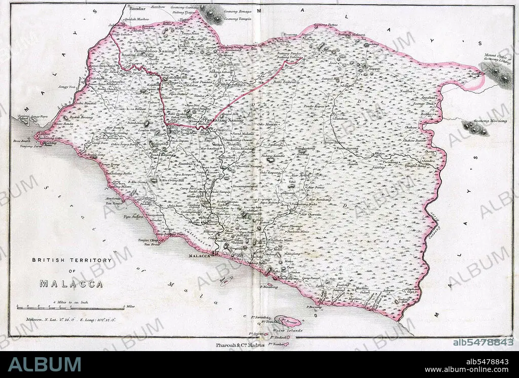
Map of Mount Ophire, Melaka (Malacca), British Straits Settlements,1854.
| Compartir |
|---|
 Pinterest Pinterest |
 Twitter Twitter |
 Facebook Facebook |
 Copiar enlace Copiar enlace |
 Email Email |
|
Añadir a otro lightbox |
|
Añadir a otro lightbox |


¿Ya tienes cuenta? Iniciar sesión
¿No tienes cuenta? Regístrate
Compra esta imagen

Título:
Map of Mount Ophire, Melaka (Malacca), British Straits Settlements,1854.
Descripción:
Ver traducción automática
The Straits Settlements were a group of British territories located in Southeast Asia. Originally established in 1826 as part of the territories controlled by the British East India Company, the Straits Settlements came under direct British control as a crown colony on 1 April 1867. The colony was dissolved in 1946 as part of the British reorganisation of its South-East Asian dependencies following the end of the Second World War. The Straits Settlements consisted of the four individual settlements of Malacca, Dinding, Penang (also known as Prince of Wales Island), Singapore (with Christmas Island and the Cocos Islands). The island of Labuan, off the coast of Borneo, was also incorporated into the colony with effect from 1 January 1907, becoming a separate settlement within it in 1912. With the exception of Singapore, Christmas Island, and the Cocos Islands, these territories now form part of Malaysia.
Crédito:
Album / Pictures From History/Universal Images Group
Autorizaciones:
Modelo: No - Propiedad: No
¿Preguntas relacionadas con los derechos?
¿Preguntas relacionadas con los derechos?
Tamaño imagen:
5100 x 3444 px | 50.3 MB
Tamaño impresión:
43.2 x 29.2 cm | 17.0 x 11.5 in (300 dpi)
