alb9202363
Gulf Stream and North Atlantic Current, Map
| Compartir |
|---|
 Pinterest Pinterest |
 Twitter Twitter |
 Facebook Facebook |
 Copiar enlace Copiar enlace |
 Email Email |
|
Añadir a otro lightbox |
|
Añadir a otro lightbox |


¿Ya tienes cuenta? Iniciar sesión
¿No tienes cuenta? Regístrate
Compra esta imagen.
Selecciona el uso:

Título: Gulf Stream and North Atlantic Current, Map
Descripción: Ver traducción automática
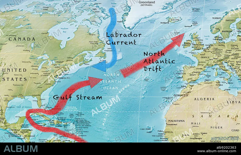
A map of the Gulf Stream, North Atlantic Drift, and Labrador Current in the Atlantic Ocean.
A map of the Gulf Stream, North Atlantic Drift, and Labrador Current in the Atlantic Ocean.
Crédito: Album / CIA/Jessica Wilson / Science Source
Autorizaciones: ? Cesión de modelo: No - ? Cesión de propiedad: No
¿Preguntas relacionadas con los derechos?
¿Preguntas relacionadas con los derechos?
Tamaño imagen: 3792 × 2243 px | 24.3 MB
Tamaño impresión: 32.1 × 19.0 cm | 1492.9 × 883.1 in (300 dpi)
