alb8388764
HARRIS & EWING. Map showing Fort Sumter and Fort Moultrie, between 1909 and 1914. Creator: Harris & Ewing.
| Compartir |
|---|
 Pinterest Pinterest |
 Twitter Twitter |
 Facebook Facebook |
 Copiar enlace Copiar enlace |
 Email Email |
|
Añadir a otro lightbox |
|
Añadir a otro lightbox |


¿Ya tienes cuenta? Iniciar sesión
¿No tienes cuenta? Regístrate
Compra esta imagen.
Selecciona el uso:

Autor:
Título:
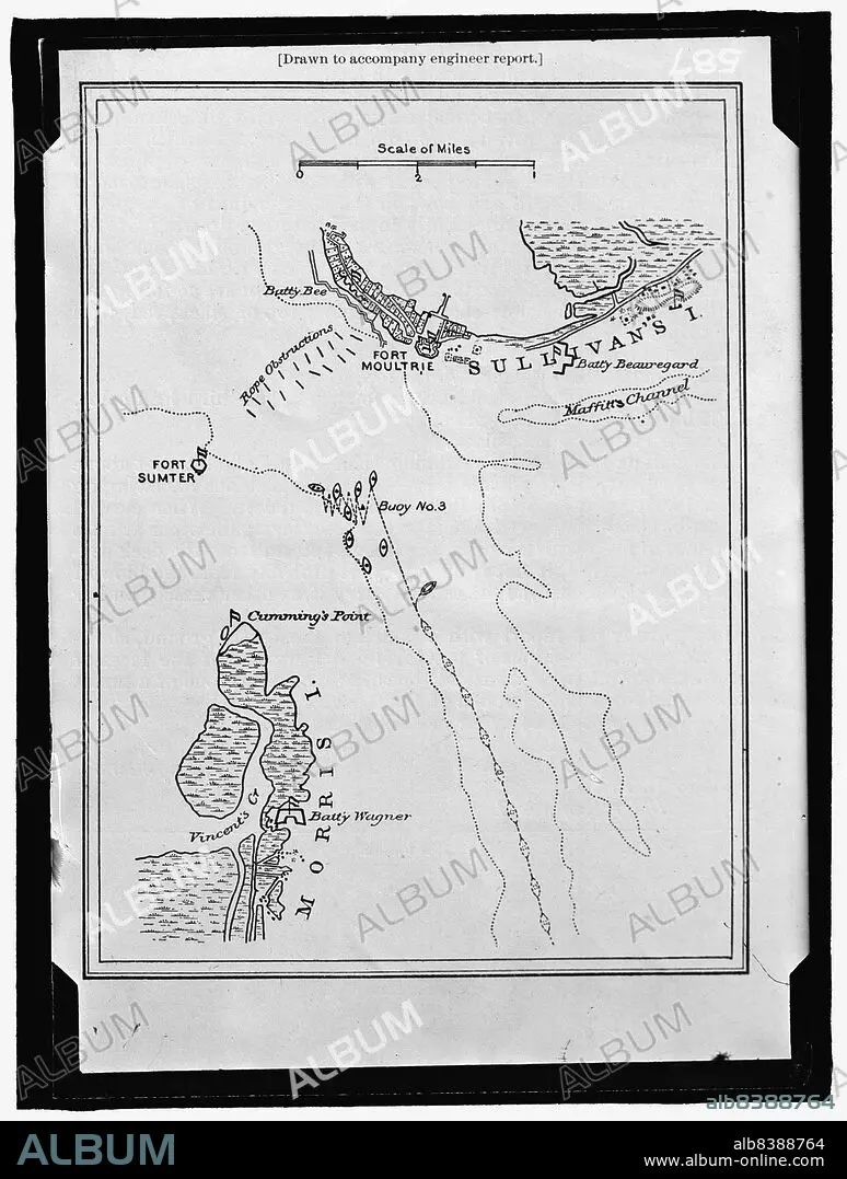
Map showing Fort Sumter and Fort Moultrie, between 1909 and 1914. Creator: Harris & Ewing.
Descripción:
Ver traducción automática
Map showing Fort Sumter and Fort Moultrie, between 1909 and 1914. 'Drawn to accompany engineer report'. Battle site, Charleston Harbour, South Carolina: Battery Bee, rope obstructions, Sullivan's Island, Maffitt's Channel, buoys, Cumming's Point, Vincent's Creek, Morris Island, Battery Wagner.
Técnica/material:
Fotografía
Crédito:
Album / Heritage Art/Heritage Images
Autorizaciones:
Tamaño imagen:
7741 x 10235 px | 226.7 MB
Tamaño impresión:
65.5 x 86.7 cm | 25.8 x 34.1 in (300 dpi)
Palabras clave:
90S • AMERICA • AMERICANO • AÑOS NOVENTA • BATALLA • BLANCO Y NEGRO • COLECCION • CONCEPTO • DÉCADA DE 1910 • DECADA NOVENTA • EDIFICIO • ESTADOS UNIDOS DE AMERICA • ESTADOS UNIDOS • FORTIFICACION • FORTIFICACIONES • FOTOGRAFIA • FUERTE (EDIFICIO) • GUERRA • HARRIS & EWING • KUNTZE • MAPA • MARTA DE BETANIA • NEGATIVO FOTOGRAFICO • PAÍS • PLACA FOTOGRÁFICA • PUERTO • REBELION • REVOLUCIÓN • SANTA MARTA • SIGLO XX • SIGLO
