alb1962114
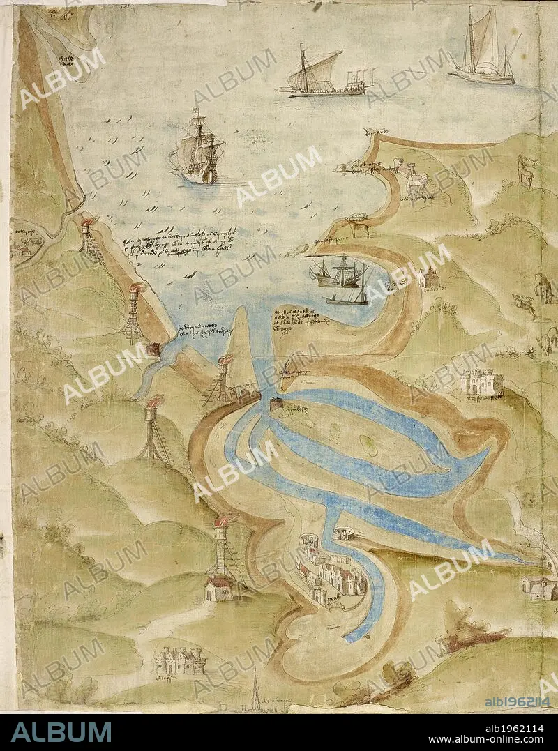
Map of Mount's Bay in Cornwall. Coastline. Sand flats and sheltered estuary and bay. Ships. . A Large colored chart of Mount’s Bay, in Cornwall. Cornwall, drawn c. 1540. A Large colored chart of Mount’s Bay, in Cornwall, drawn c. 1540. . Source: Cotton Augustus I. I 31-33 (detail). Language: English.
| Compartir |
|---|
 Pinterest Pinterest |
 Twitter Twitter |
 Facebook Facebook |
 Copiar enlace Copiar enlace |
 Email Email |
|
Añadir a otro lightbox |
|
Añadir a otro lightbox |


¿Ya tienes cuenta? Iniciar sesión
¿No tienes cuenta? Regístrate
Compra esta imagen.
Selecciona el uso:

Descripción:
Ver traducción automática
Map of Mount's Bay in Cornwall. Coastline. Sand flats and sheltered estuary and bay. Ships. . A Large colored chart of Mount’s Bay, in Cornwall. Cornwall, drawn c. 1540. A Large colored chart of Mount’s Bay, in Cornwall, drawn c. 1540. . Source: Cotton Augustus I. I 31-33 (detail). Language: English.
Crédito:
Album / British Library
Autorizaciones:
Modelo: No - Propiedad: No
¿Preguntas relacionadas con los derechos?
¿Preguntas relacionadas con los derechos?
Tamaño imagen:
4866 x 6226 px | 86.7 MB
Tamaño impresión:
41.2 x 52.7 cm | 16.2 x 20.8 in (300 dpi)
Palabras clave:
BAHIA • BARCO • CARTOGRAFIA • COSTA • EMBARCADERO • EUROPA OCCIDENTAL • EUROPA • GOLFO • GRAN BRETAÑA • INGLATERRA • ISLAS BRITANICAS • MAPA • PUERTO • REINO UNIDO • TOPOGRAFIA • TRANSPORTE • VEHICULO ACUATICO
