alb9527663
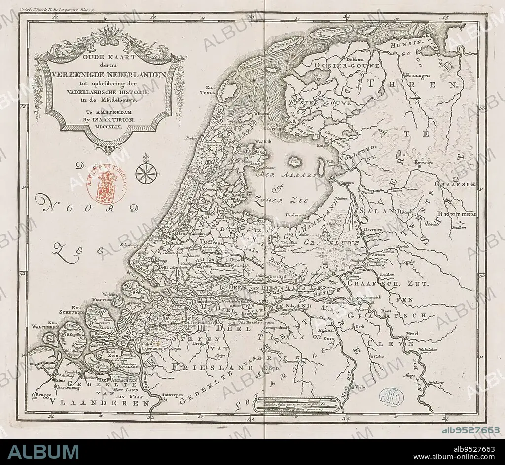
Historical map of Holland in the Middle Ages, Old map of the now united Netherlands to elucidate patriotic history in the Middle Ages (title on object), Eighteenth-century map of Holland in the Middle Ages. Title cartouche to the left. Right scale bar: German mylen of 15 in a degree, Dutch mylen or hours gaans. Degree divisions along edges., print maker: anonymous, publisher: Isaak Tirion, (mentioned on object), Amsterdam, 1749, paper, engraving, height 289 mm × width 329 mm.
| Compartir |
|---|
 Pinterest Pinterest |
 Twitter Twitter |
 Facebook Facebook |
 Copiar enlace Copiar enlace |
 Email Email |
|
Añadir a otro lightbox |
|
Añadir a otro lightbox |


¿Ya tienes cuenta? Iniciar sesión
¿No tienes cuenta? Regístrate
Compra esta imagen.
Selecciona el uso:

Descripción:
Ver traducción automática
Historical map of Holland in the Middle Ages, Old map of the now united Netherlands to elucidate patriotic history in the Middle Ages (title on object), Eighteenth-century map of Holland in the Middle Ages. Title cartouche to the left. Right scale bar: German mylen of 15 in a degree, Dutch mylen or hours gaans. Degree divisions along edges., print maker: anonymous, publisher: Isaak Tirion, (mentioned on object), Amsterdam, 1749, paper, engraving, height 289 mm × width 329 mm
Crédito:
Album / quintlox
Autorizaciones:
Tamaño imagen:
2914 x 2534 px | 21.1 MB
Tamaño impresión:
24.7 x 21.5 cm | 9.7 x 8.4 in (300 dpi)
Palabras clave:
1749 • AGUAFUERTE • AMSTERDAM • ANONIMA • ANONIMO • EDAD MEDIA • EDITOR • ENGRAVING • GRABADO • GRABADOS • GRADO • HOLANDA • IZQUIERDA • MAPA ANTIGUO • MAPA HISTORICO • OBJETO • PAPEL
