alb2180635
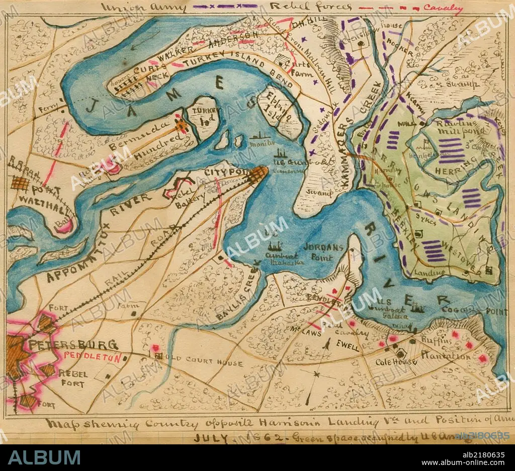
Harrison's Landing, Va., and position of U. S. Army. 1862
| Compartir |
|---|
 Pinterest Pinterest |
 Twitter Twitter |
 Facebook Facebook |
 Copiar enlace Copiar enlace |
 Email Email |
|
Añadir a otro lightbox |
|
Añadir a otro lightbox |


¿Ya tienes cuenta? Iniciar sesión
¿No tienes cuenta? Regístrate
Compra esta imagen.
Selecciona el uso:

Título: Harrison's Landing, Va., and position of U. S. Army. 1862
Descripción: Ver traducción automática
location along the James River between Petersburg and Harrison's Landing, Va., of the camps of the U.S. Army of the Potomac after the Seven Days' Battles, 26 June-1 July 1862. Positions of U.S. gunboats are indicated along the James River as well as Confederate strongholds and positions of the Cavalry.
location along the James River between Petersburg and Harrison's Landing, Va., of the camps of the U.S. Army of the Potomac after the Seven Days' Battles, 26 June-1 July 1862. Positions of U.S. gunboats are indicated along the James River as well as Confederate strongholds and positions of the Cavalry.
Crédito: Album / Universal Images Group / Universal History Archive/UIG
Autorizaciones: ? Cesión de modelo: No - ? Cesión de propiedad: No
¿Preguntas relacionadas con los derechos?
¿Preguntas relacionadas con los derechos?
Tamaño imagen: 1891 × 1633 px | 8.8 MB
Tamaño impresión: 16.0 × 13.8 cm | 744.5 × 642.9 in (300 dpi)
Palabras clave: 1862 • CARTOGRAFIA • CARTOGRAFICO • CIVIL • CONFLICTO BELICO • EJERCITO • FÉDÉRAL • FUERTE (EDIFICIO) • GEORGIA • GUERRA • GUERRAS • MAPA • MAPAS • NORTE • POTOMAC • WAR
