alb3192646
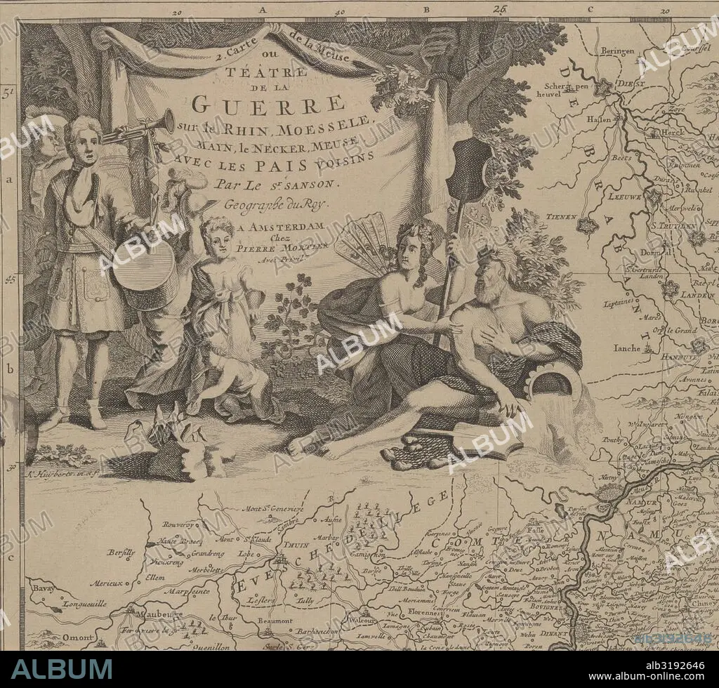
Map of the area east and south of Brussels and the county of Namur (leaf left) Belgium, Cornelis Huyberts, Sanson, Pieter Mortier, 1689 - 1712.
| Compartir |
|---|
 Pinterest Pinterest |
 Twitter Twitter |
 Facebook Facebook |
 Copiar enlace Copiar enlace |
 Email Email |
|
Añadir a otro lightbox |
|
Añadir a otro lightbox |


¿Ya tienes cuenta? Iniciar sesión
¿No tienes cuenta? Regístrate
Compra esta imagen.
Selecciona el uso:

Descripción:
Ver traducción automática
Map of the area east and south of Brussels and the county of Namur (leaf left) Belgium, Cornelis Huyberts, Sanson, Pieter Mortier, 1689 - 1712
Crédito:
Album / quintlox
Autorizaciones:
Modelo: No - Propiedad: No
¿Preguntas relacionadas con los derechos?
¿Preguntas relacionadas con los derechos?
Tamaño imagen:
5314 x 4812 px | 73.2 MB
Tamaño impresión:
45.0 x 40.7 cm | 17.7 x 16.0 in (300 dpi)
Palabras clave:
1695 • ALEGORIA • AMOR • BELGICA • BELLEZA • BRUSELAS • CARTOGRAFIA • CASCO • CONDADO • GEOGRAFIA • GEOGRAFICO • HELMET • HEROISMO • HOJA DE PAPEL • HOJA • HOLANDES • HOLANDESA • HOMBRE • MAPA • MARS • MARTE • MUNDO • NAMUR • OCUPACION • ORIENTE • PUTTO • REGIONES • RETRATO DE HOMBRE • SUR • TAMBOR • TIERRA • TROMPETA • TWIST • VENUS • VICTORIA
