alb3408391
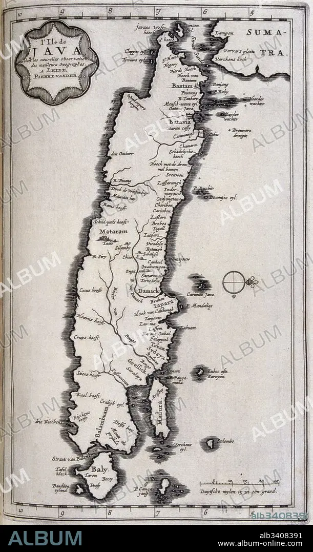
Map of Java in the Dutch East Indies, circa 1680, 17th century.
| Compartir |
|---|
 Pinterest Pinterest |
 Twitter Twitter |
 Facebook Facebook |
 Copiar enlace Copiar enlace |
 Email Email |
|
Añadir a otro lightbox |
|
Añadir a otro lightbox |


¿Ya tienes cuenta? Iniciar sesión
¿No tienes cuenta? Regístrate
Compra esta imagen

Título:
Map of Java in the Dutch East Indies, circa 1680, 17th century.
Descripción:
Ver traducción automática
Map of Java in the Dutch East Indies, circa 1680, 17th century. Illustration from voyages made to Persia and India 1727, by Johan Albrecht de Mandelslo (1616–1644). seventeenth-century German adventurer, who wrote about his travels through Persia and India.
Crédito:
Album / Universal Images Group / Universal History Archive \ UIG
Autorizaciones:
Modelo: No - Propiedad: No
¿Preguntas relacionadas con los derechos?
¿Preguntas relacionadas con los derechos?
Tamaño imagen:
3043 x 5100 px | 44.4 MB
Tamaño impresión:
25.8 x 43.2 cm | 10.1 x 17.0 in (300 dpi)
Palabras clave:
CARTOGRAFIA • ESTUDIO DE FOTOGRAFIA • FOTOGRAMA COMPLETO • HISTORIA • ILUSTRACION • INDIA • JAVA • LIBRO • MAPA • PASADO, EL • SIGLO XVII • SIN GENTE • VERTICAL
