alb3547538
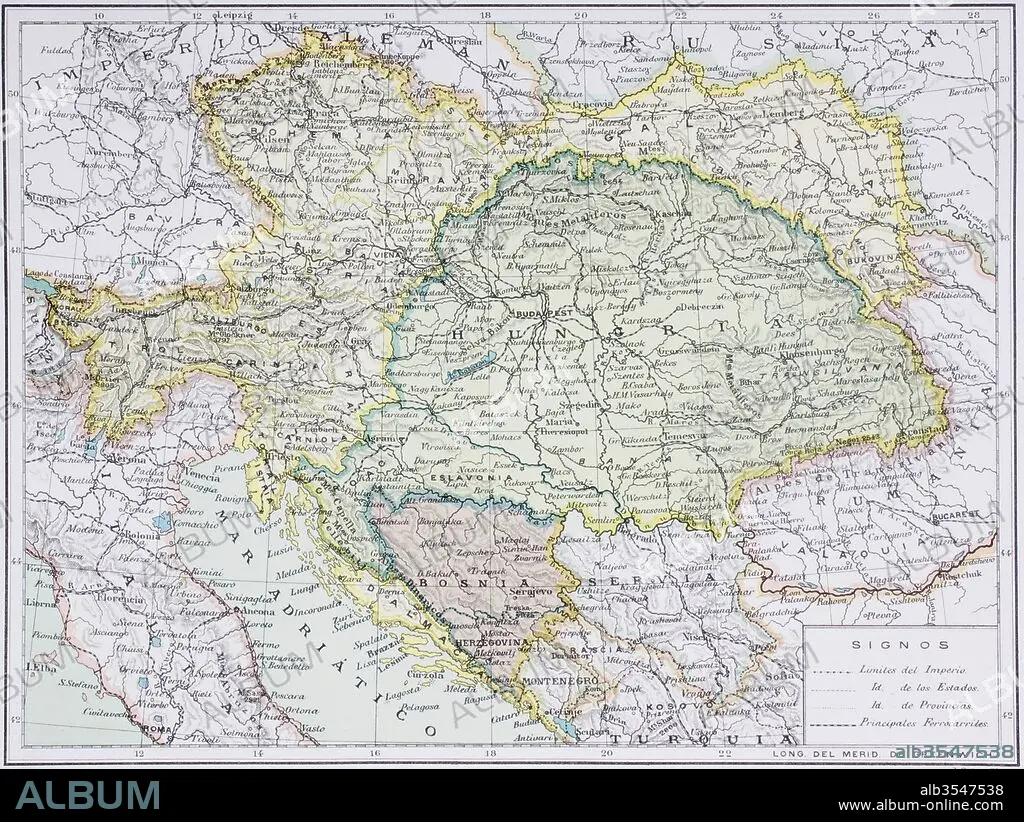
Map of the Austro-Hungarian empire at the turn of the 20th century
| Compartir |
|---|
 Pinterest Pinterest |
 Twitter Twitter |
 Facebook Facebook |
 Copiar enlace Copiar enlace |
 Email Email |
|
Añadir a otro lightbox |
|
Añadir a otro lightbox |


¿Ya tienes cuenta? Iniciar sesión
¿No tienes cuenta? Regístrate
Compra esta imagen.
Selecciona el uso:

Título: Map of the Austro-Hungarian empire at the turn of the 20th century
Descripción: Ver traducción automática
Map of the Austro-Hungarian empire at the turn of the 20th century. Map is in Spanish language. From Enciclopedia Ilustrada Seguí, published Barcelona circa 1910.
Map of the Austro-Hungarian empire at the turn of the 20th century. Map is in Spanish language. From Enciclopedia Ilustrada Seguí, published Barcelona circa 1910.
Crédito: Album / Universal Images Group / Universal History Archive
Autorizaciones: ? Cesión de modelo: No - ? Cesión de propiedad: No
¿Preguntas relacionadas con los derechos?
¿Preguntas relacionadas con los derechos?
Tamaño imagen: 5079 × 3815 px | 55.4 MB
Tamaño impresión: 43.0 × 32.3 cm | 1999.6 × 1502.0 in (300 dpi)
