alb5938969
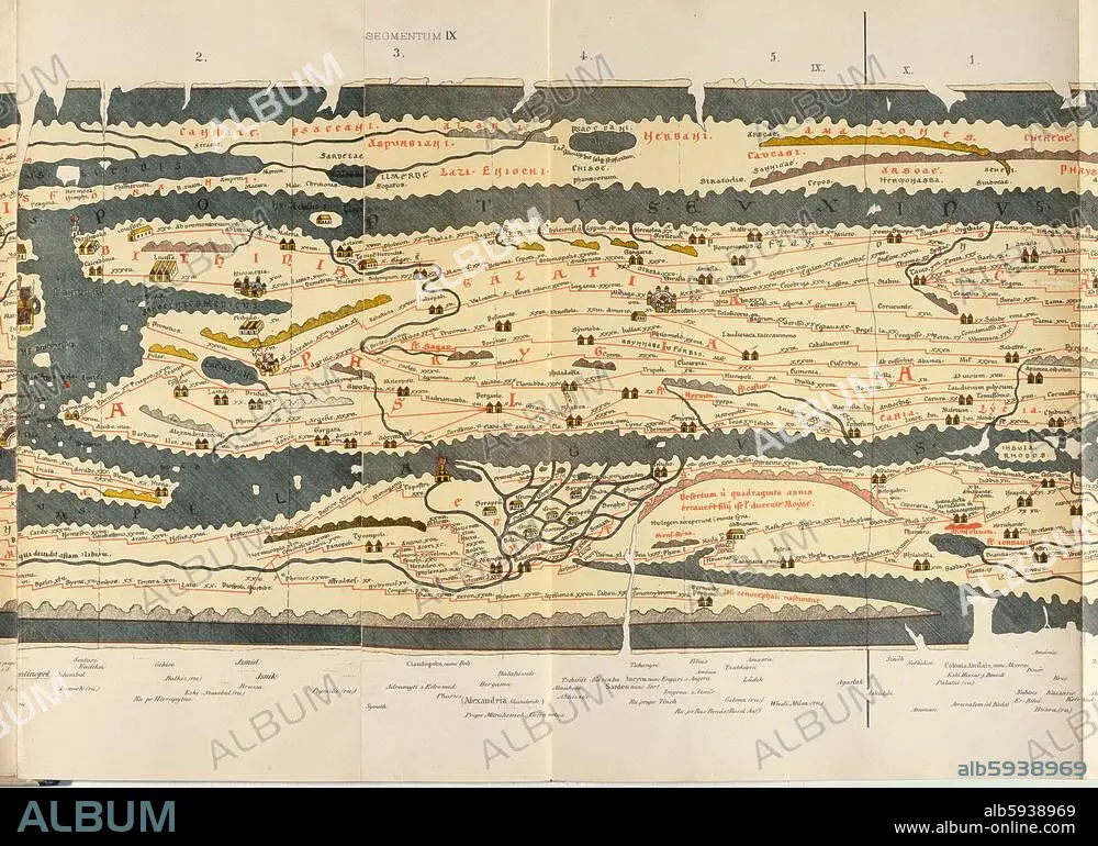
ANÓNIMO. Peutinger Table / 9th Sheet / 1264
| Compartir |
|---|
 Pinterest Pinterest |
 Twitter Twitter |
 Facebook Facebook |
 Copiar enlace Copiar enlace |
 Email Email |
|
Añadir a otro lightbox |
|
Añadir a otro lightbox |


¿Ya tienes cuenta? Iniciar sesión
¿No tienes cuenta? Regístrate
Compra esta imagen.
Selecciona el uso:

Autor:
Título:
Peutinger Table / 9th Sheet / 1264
Descripción:
Ver traducción automática
Geography / Maps of the World. Peutinger Table (copy of a map of the Romam empire (version of C3rd AD) made in 1264); 9th sheet: Asia Minor and Egypt. Colour lithograph. From: World map of Castorius, called the Peutinger Table, published by Konrad Miller, Ravensburg (O.Maier) 1888. Berlin, Museum für Kommunikation.
Obra:
MAPAMUNDI DE CASTORIUS
Técnica/material:
ARTES GRAFICAS • IMPRESION
Museo:
Berlin, Museum für Kommunikation
Crédito:
Album / akg-images
Autorizaciones:
Modelo: No - Propiedad: No
¿Preguntas relacionadas con los derechos?
¿Preguntas relacionadas con los derechos?
Tamaño imagen:
4961 x 3555 px | 50.5 MB
Tamaño impresión:
42.0 x 30.1 cm | 16.5 x 11.8 in (300 dpi)
Palabras clave:
ALEJANDRIA • ANONIMO • ANTIGÜEDAD • ANTIGÜEDADES • ANTIQUITY • ARTES GRAFICAS • ASIA MENOR • BERLIN • BERLIN, MUSEUM FÜR KOMMUNIKATION • CARTOGRAFIA • EGIPCIA • EGIPCIAS • EGIPCIO • EGIPTO • FARO • GEOGRAFIA • IMPERIO BIZANTINO • IMPERIO ROMANO • IMPRESION • KONRAD MILLER • LITOGRAFIA • MAPA DE CARRETERAS • MAPA DEL MUNDO • MAPA MUNDI • MAPAMUNDI DE CASTORIUS • MAPAMUNDI • ROMA IMPERIAL • S. III • S. XIII • SIGLO III DC • SIGLO III • SIGLO XIII • TRAFICO • VISTA PARCIAL
