alb4088374
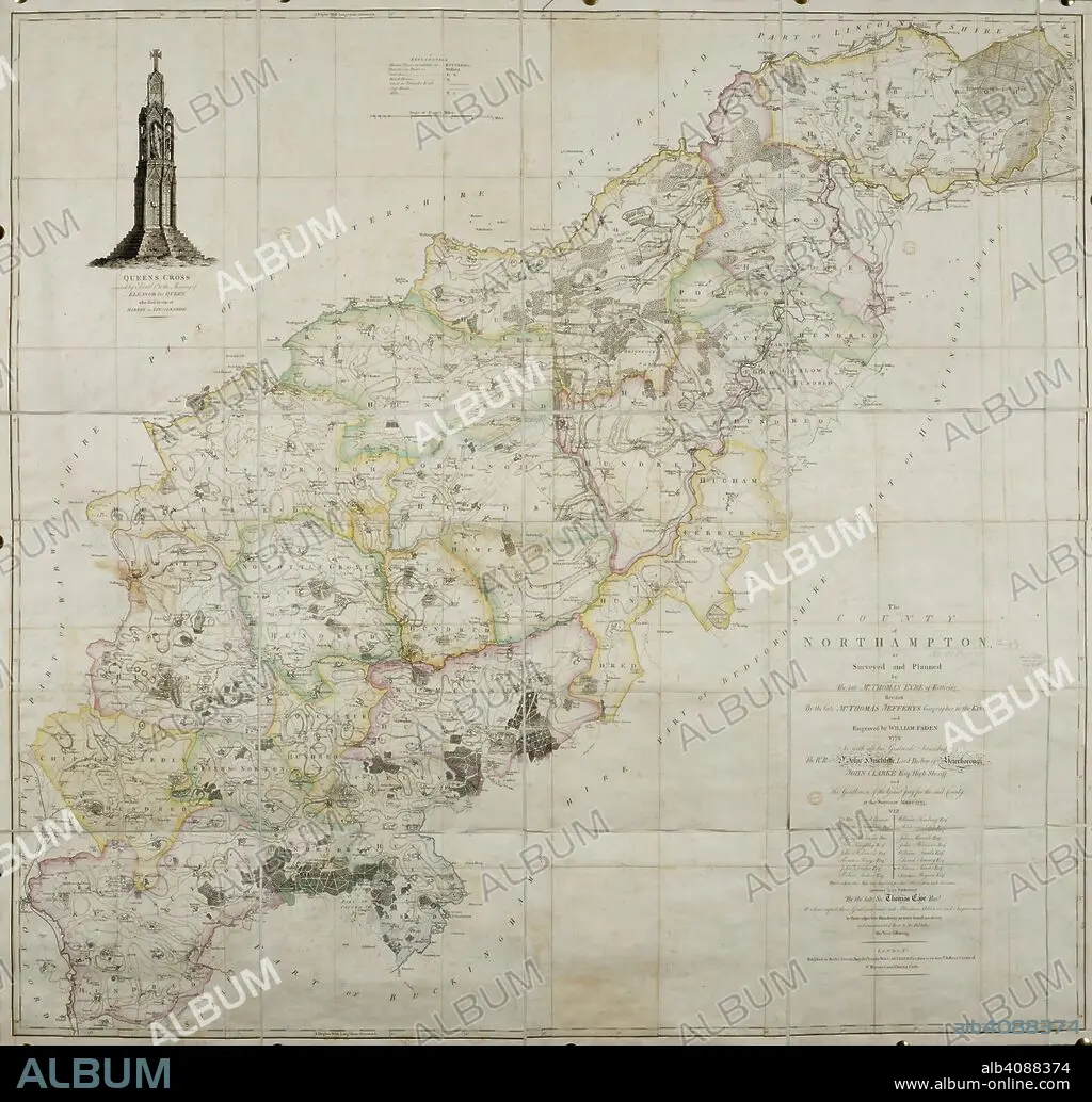
THOMAS JEFFREYS y W FADEN. 18th century map of the county of Northamptonshire. . The County of Northamptonshire, as surveyed and planned by the late T. Eyre, revised by the late T. Jefferys, and engraved by W. Faden. London, 1779. Source: Maps*4420.(3).
| Compartir |
|---|
 Pinterest Pinterest |
 Twitter Twitter |
 Facebook Facebook |
 Copiar enlace Copiar enlace |
 Email Email |
|
Añadir a otro lightbox |
|
Añadir a otro lightbox |


¿Ya tienes cuenta? Iniciar sesión
¿No tienes cuenta? Regístrate
Compra esta imagen.
Selecciona el uso:

Autor: THOMAS JEFFREYS • W FADEN
Descripción: Ver traducción automática
18th century map of the county of Northamptonshire. . The County of Northamptonshire, as surveyed and planned by the late T. Eyre, revised by the late T. Jefferys, and engraved by W. Faden. London, 1779. Source: Maps*4420.(3).
18th century map of the county of Northamptonshire. . The County of Northamptonshire, as surveyed and planned by the late T. Eyre, revised by the late T. Jefferys, and engraved by W. Faden. London, 1779. Source: Maps*4420.(3).
Crédito: Album / British Library
Autorizaciones: ? Cesión de modelo: No - ? Cesión de propiedad: No
¿Preguntas relacionadas con los derechos?
¿Preguntas relacionadas con los derechos?
Tamaño imagen: 6647 × 6367 px | 121.1 MB
Tamaño impresión: 56.3 × 53.9 cm | 2616.9 × 2506.7 in (300 dpi)
Palabras clave: ALBION • CARTOGRAFIA • CARTOGRAFICO • COLOR • COLORES • COLORIDO • EUROPA OCCIDENTAL • EUROPA • FADEN, W • GRAN BRETAÑA • INGLATERRA • ISLAS BRITANICAS • JEFFREYS, THOMAS • MAPA • MAPAS • REINO UNIDO • S. XVIII • SIGLO XVIII
