alb1960487
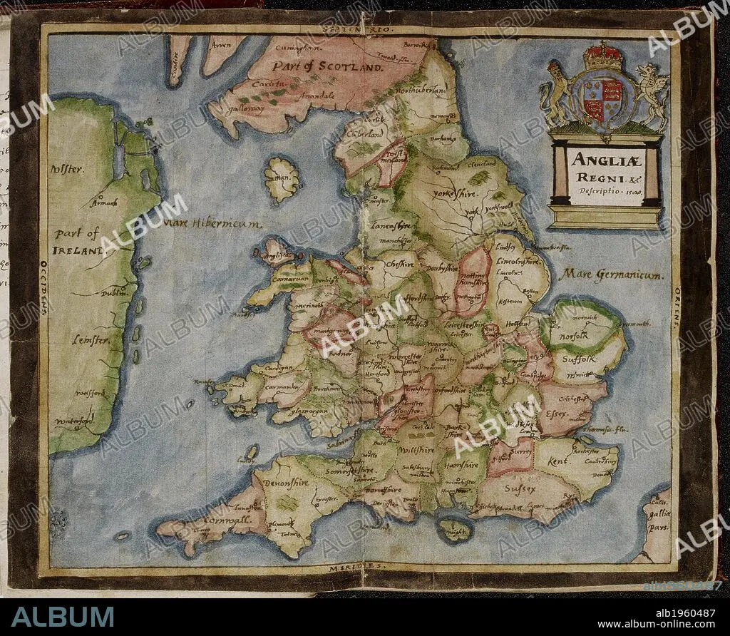
Map of Anglia Regni (England, Wales and a coast of Ireland). The Particular Description of England. 1588. Source: Sloane 2596 between ff.5v-6. Language: Latin.
| Compartir |
|---|
 Pinterest Pinterest |
 Twitter Twitter |
 Facebook Facebook |
 Copiar enlace Copiar enlace |
 Email Email |
|
Añadir a otro lightbox |
|
Añadir a otro lightbox |


¿Ya tienes cuenta? Iniciar sesión
¿No tienes cuenta? Regístrate
Compra esta imagen.
Selecciona el uso:

Descripción: Ver traducción automática
Map of Anglia Regni (England, Wales and a coast of Ireland). The Particular Description of England. 1588. Source: Sloane 2596 between ff.5v-6. Language: Latin.
Map of Anglia Regni (England, Wales and a coast of Ireland). The Particular Description of England. 1588. Source: Sloane 2596 between ff.5v-6. Language: Latin.
Crédito: Album / British Library
Autorizaciones: ? Cesión de modelo: No - ? Cesión de propiedad: No
¿Preguntas relacionadas con los derechos?
¿Preguntas relacionadas con los derechos?
Tamaño imagen: 6252 × 5120 px | 91.6 MB
Tamaño impresión: 52.9 × 43.3 cm | 2461.4 × 2015.7 in (300 dpi)
Palabras clave: CARTOGRAFIA • CARTOGRAFICO • MAPA • MAPAS • S. XVI • SIGLO XVI
