alb4632971
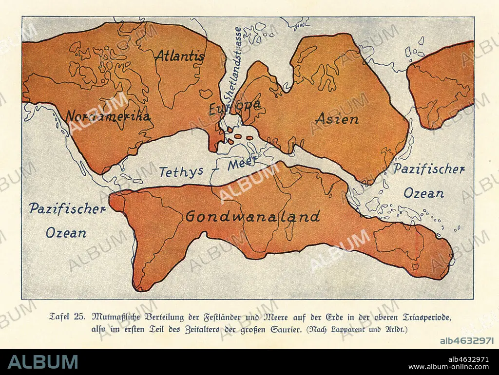
Map of the continents and seas in the Upper Triassic period. North America, Atlantis, Europe, Asia, Gondwanaland. Colour print after an illustration from Wilhelm Bolsches Das Leben der Urwelt, Prehistoric Life, Georg Dollheimer, Leipzig, 1932.
| Compartir |
|---|
 Pinterest Pinterest |
 Twitter Twitter |
 Facebook Facebook |
 Copiar enlace Copiar enlace |
 Email Email |
|
Añadir a otro lightbox |
|
Añadir a otro lightbox |


¿Ya tienes cuenta? Iniciar sesión
¿No tienes cuenta? Regístrate
Compra esta imagen.
Selecciona el uso:

Descripción: Ver traducción automática
Map of the continents and seas in the Upper Triassic period. North America, Atlantis, Europe, Asia, Gondwanaland. Colour print after an illustration from Wilhelm Bolsches Das Leben der Urwelt, Prehistoric Life, Georg Dollheimer, Leipzig, 1932.
Map of the continents and seas in the Upper Triassic period. North America, Atlantis, Europe, Asia, Gondwanaland. Colour print after an illustration from Wilhelm Bolsches Das Leben der Urwelt, Prehistoric Life, Georg Dollheimer, Leipzig, 1932.
Crédito: Album / Florilegius
Autorizaciones: ? Cesión de modelo: No - ? Cesión de propiedad: No
¿Preguntas relacionadas con los derechos?
¿Preguntas relacionadas con los derechos?
Tamaño imagen: 6581 × 4605 px | 86.7 MB
Tamaño impresión: 55.7 × 39.0 cm | 2590.9 × 1813.0 in (300 dpi)
Palabras clave: AMÉRICA DEL NORTE • AMERICA SEPTENTRIONAL • ASIA • ATLANTIDA • CONTINENTES • EUROPA • EXTINGUIDO • FLOTA • ILUSTRACION • ILUSTRACIONES • MAPA • MAPAS • MAR • MARINA • MARINE • NORTEAMERICA • OCEANO • PALEONTOLOGIA • PREHISTORIA • SEA • ZOOLOGIA
