alb3930435
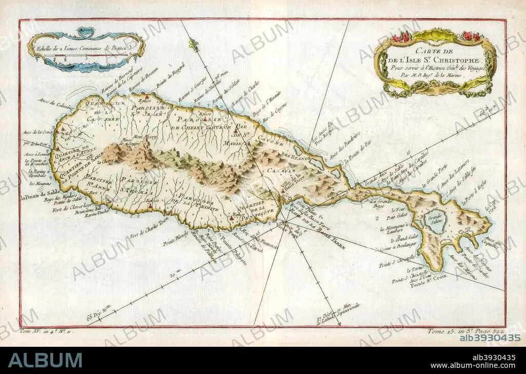
Map of the Caribbean island of St Christopher, c1764. Artist: Unknown
| Compartir |
|---|
 Pinterest Pinterest |
 Twitter Twitter |
 Facebook Facebook |
 Copiar enlace Copiar enlace |
 Email Email |
|
Añadir a otro lightbox |
|
Añadir a otro lightbox |


¿Ya tienes cuenta? Iniciar sesión
¿No tienes cuenta? Regístrate
Compra esta imagen.
Selecciona el uso:

Título:
Map of the Caribbean island of St Christopher, c1764. Artist: Unknown
Descripción:
Ver traducción automática
Map of the Caribbean island of St Christopher, c1764.
Crédito:
Album / The Print Collector / Heritage Images
Autorizaciones:
Modelo: No - Propiedad: No
¿Preguntas relacionadas con los derechos?
¿Preguntas relacionadas con los derechos?
Tamaño imagen:
5141 x 3391 px | 49.9 MB
Tamaño impresión:
43.5 x 28.7 cm | 17.1 x 11.3 in (300 dpi)
Palabras clave:
1 • BRITANICO • CARIBE • CARTOGRAFIA • COLONIA (TERRITORIO) • COLOR • COLORIDO • FRANCES • FRANCIA • GEOGRAFIA • GRABADO • GRAN BRETAÑA • IMPERIO BRITANICO • INDIAS OCCIDENTALES • ISLA • MAPA • MAR • PAÍS • PEQUEÑAS ANTILLAS • S. XVIII • SIGLO XVIII • SIGLO • TOPOGRAFIA • TOPOGRÁFICOS
