alb5409621
Slave Trade of Africa Map,1899
| Compartir |
|---|
 Pinterest Pinterest |
 Twitter Twitter |
 Facebook Facebook |
 Copiar enlace Copiar enlace |
 Email Email |
|
Añadir a otro lightbox |
|
Añadir a otro lightbox |


¿Ya tienes cuenta? Iniciar sesión
¿No tienes cuenta? Regístrate
Compra esta imagen.
Selecciona el uso:

Título: Slave Trade of Africa Map,1899
Descripción: Ver traducción automática
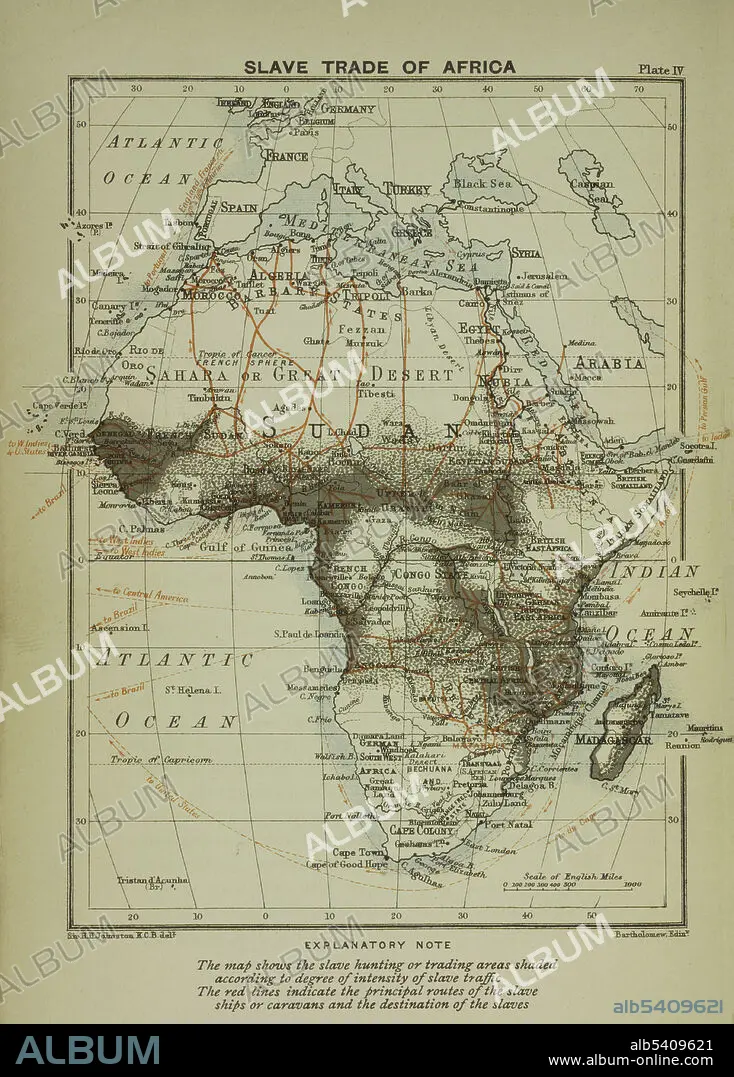
A map of the slave trade in Africa that shows the regions of most intense activity. The map shows the slave hunting or trading areas shaded according to degree of intensity of slave traffic. The red lines indicate the principal routes of the slave ships or caravans and the destination of the slaves.
A map of the slave trade in Africa that shows the regions of most intense activity. The map shows the slave hunting or trading areas shaded according to degree of intensity of slave traffic. The red lines indicate the principal routes of the slave ships or caravans and the destination of the slaves.
Crédito: Album / NYPL/Science Source
Autorizaciones: ? Cesión de modelo: No - ? Cesión de propiedad: No
¿Preguntas relacionadas con los derechos?
¿Preguntas relacionadas con los derechos?
Tamaño imagen: 3441 × 4800 px | 47.3 MB
Tamaño impresión: 29.1 × 40.6 cm | 1354.7 × 1889.8 in (300 dpi)
Palabras clave: 1899 • AFRICA • BLANCO Y NEGRO • CARTOGRAFIA • DESTINO • ESCLAVISMO • ESCLAVITUD • HISTORIA • MAPA • SIGLO XIX
