alb1963200
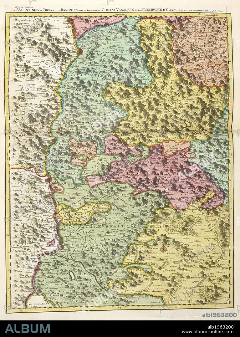
S SANSON. A map of inland landlocked countries in Europe. . Atlas Nouveau aÌ€ l’usage de MonseÌigneur le Duc de Bourgoyne. Amsterdam Netherlands 1700. Source: Maps 39.f.14 Map 200. Language: French.
| Compartir |
|---|
 Pinterest Pinterest |
 Twitter Twitter |
 Facebook Facebook |
 Copiar enlace Copiar enlace |
 Email Email |
|
Añadir a otro lightbox |
|
Añadir a otro lightbox |


¿Ya tienes cuenta? Iniciar sesión
¿No tienes cuenta? Regístrate
Compra esta imagen.
Selecciona el uso:

Autor:
Descripción:
Ver traducción automática
A map of inland landlocked countries in Europe. . Atlas Nouveau aÌ€ l’usage de MonseÌigneur le Duc de Bourgoyne. Amsterdam Netherlands 1700. Source: Maps 39.f.14 Map 200. Language: French.
Crédito:
Album / British Library
Autorizaciones:
Tamaño imagen:
3798 x 5068 px | 55.1 MB
Tamaño impresión:
32.2 x 42.9 cm | 12.7 x 16.9 in (300 dpi)
Palabras clave:
