alb9020618
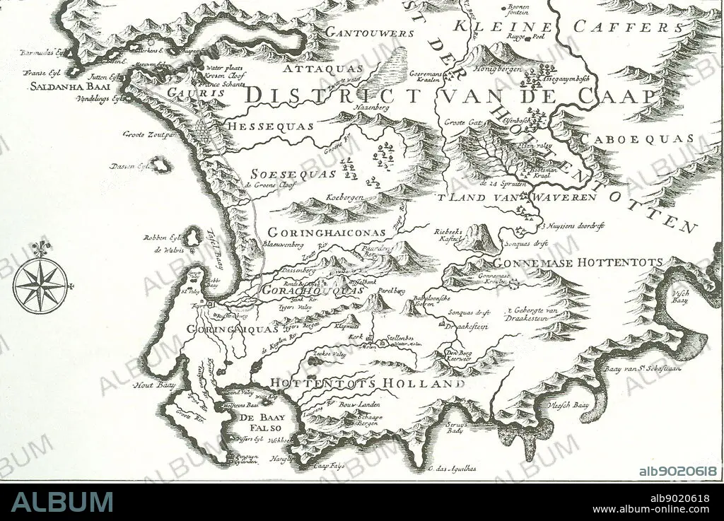
District of the Cape' (The Good Hope)' - map of a portion of the present Cape Colony. The former ship's doctor Johan van Riebeek landed in Table Bay in 1652 and built the beginning of a Dutch settlement in South Africa.
| Compartir |
|---|
 Pinterest Pinterest |
 Twitter Twitter |
 Facebook Facebook |
 Copiar enlace Copiar enlace |
 Email Email |
|
Añadir a otro lightbox |
|
Añadir a otro lightbox |


¿Ya tienes cuenta? Iniciar sesión
¿No tienes cuenta? Regístrate
Compra esta imagen.
Selecciona el uso:

Descripción:
Ver traducción automática
District of the Cape' (The Good Hope)' - map of a portion of the present Cape Colony. The former ship's doctor Johan van Riebeek landed in Table Bay in 1652 and built the beginning of a Dutch settlement in South Africa.
Crédito:
Album / World History Archive
Autorizaciones:
Modelo: No - Propiedad: No
¿Preguntas relacionadas con los derechos?
¿Preguntas relacionadas con los derechos?
Tamaño imagen:
3700 x 2470 px | 26.1 MB
Tamaño impresión:
31.3 x 20.9 cm | 12.3 x 8.2 in (300 dpi)
Palabras clave:
