alb5408432
Joan Blaeu, Brie Region Map, France, 17th Century
| Compartir |
|---|
 Pinterest Pinterest |
 Twitter Twitter |
 Facebook Facebook |
 Copiar enlace Copiar enlace |
 Email Email |
|
Añadir a otro lightbox |
|
Añadir a otro lightbox |


¿Ya tienes cuenta? Iniciar sesión
¿No tienes cuenta? Regístrate
Compra esta imagen.
Selecciona el uso:

Título: Joan Blaeu, Brie Region Map, France, 17th Century
Descripción: Ver traducción automática
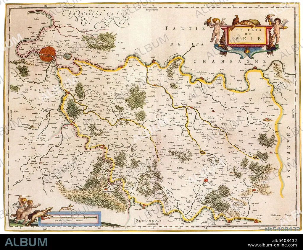
Brie is a historic region of northern France notable in modern times for Brie cheese. It was once divided into three sections ruled by different feudal lords: the western Brie francaise, corresponding roughly to the modern department of Seine-et-Marne in the Ile-de-France region, the eastern Brie champenoise, forming a portion of the modern department of Marne in the historic region of Champagne, and the northern Brie pouilleuse, forming part of the modern department of Aisne in Picardy. Joan Blaeu (1596-1673) was a Dutch cartographer, the son of cartographer Willem Blaeu. In 1635 they published the Atlas Novus (full title: Theatrum orbis terrarum, sive, Atlas novus) in two volumes. The Atlas Maior is the final version of Joan Blaeu's atlas, published in Amsterdam between 1662 and 1672, in Latin, French, Dutch, German and Spanish, containing 594 maps and around 3,000 pages of text. The Blaeu maps emphasized fine art and colours, being the most expensive of the time.
Brie is a historic region of northern France notable in modern times for Brie cheese. It was once divided into three sections ruled by different feudal lords: the western Brie francaise, corresponding roughly to the modern department of Seine-et-Marne in the Ile-de-France region, the eastern Brie champenoise, forming a portion of the modern department of Marne in the historic region of Champagne, and the northern Brie pouilleuse, forming part of the modern department of Aisne in Picardy. Joan Blaeu (1596-1673) was a Dutch cartographer, the son of cartographer Willem Blaeu. In 1635 they published the Atlas Novus (full title: Theatrum orbis terrarum, sive, Atlas novus) in two volumes. The Atlas Maior is the final version of Joan Blaeu's atlas, published in Amsterdam between 1662 and 1672, in Latin, French, Dutch, German and Spanish, containing 594 maps and around 3,000 pages of text. The Blaeu maps emphasized fine art and colours, being the most expensive of the time.
Crédito: Album / Science Source
Autorizaciones: ? Cesión de modelo: No - ? Cesión de propiedad: No
¿Preguntas relacionadas con los derechos?
¿Preguntas relacionadas con los derechos?
Tamaño imagen: 4275 × 3314 px | 40.5 MB
Tamaño impresión: 36.2 × 28.1 cm | 1683.1 × 1304.7 in (300 dpi)
Palabras clave: ATLAS • BRIE • CARTOGRAFIA • CARTOGRAFICO • DORADO • EDAD • FAMOSA • FAMOSO • FAMOSOS • FRANCES • FRANCIA • GEOGRAFIA • GEOGRAFICA • GEOGRAFICO • HISTORIA • HISTORICO • HOLANDES • IMPORTANTE • JOAN • MAPA • REGION • SIGLO XVII • SIGLO
