alb4064224
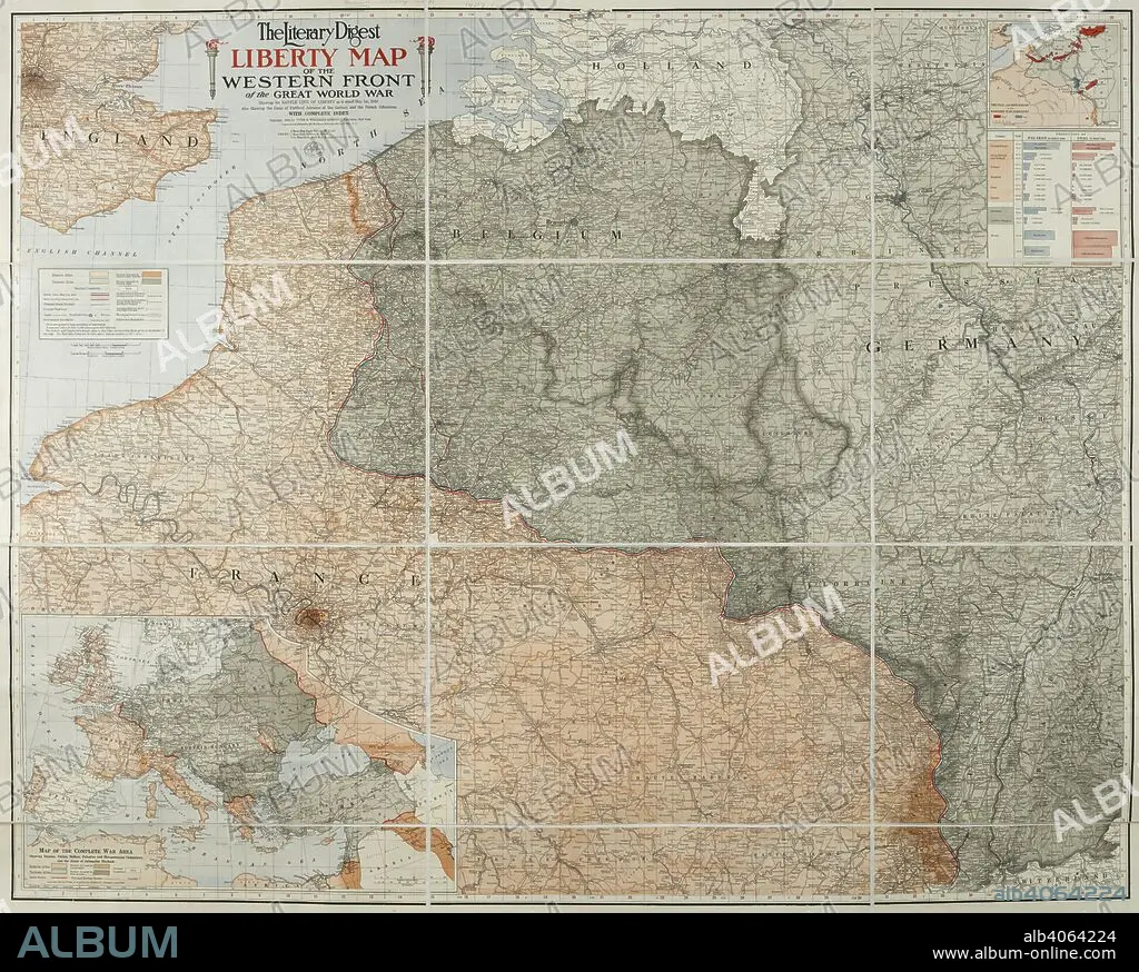
A map of the 'Western front' during the First World War. It covers mostly France, Belgium, Holland and Germany. The Literary Digest Liberty Map of the Western Front of the Great World War ... with complete index. Natural scale, 1 : 500,000. New York : Funk & Wagnalls, 1918. Source: Maps.14317.(90).
| Compartir |
|---|
 Pinterest Pinterest |
 Twitter Twitter |
 Facebook Facebook |
 Copiar enlace Copiar enlace |
 Email Email |
|
Añadir a otro lightbox |
|
Añadir a otro lightbox |


¿Ya tienes cuenta? Iniciar sesión
¿No tienes cuenta? Regístrate
Compra esta imagen.
Selecciona el uso:

Descripción:
Ver traducción automática
A map of the 'Western front' during the First World War. It covers mostly France, Belgium, Holland and Germany. The Literary Digest Liberty Map of the Western Front of the Great World War ... with complete index. Natural scale, 1 : 500,000. New York : Funk & Wagnalls, 1918. Source: Maps.14317.(90).
Crédito:
Album / British Library
Autorizaciones:
Modelo: No - Propiedad: No
¿Preguntas relacionadas con los derechos?
¿Preguntas relacionadas con los derechos?
Tamaño imagen:
7526 x 6037 px | 130.0 MB
Tamaño impresión:
63.7 x 51.1 cm | 25.1 x 20.1 in (300 dpi)
Palabras clave:
ACONTECIMIENTO • CARTOGRAFIA • CARTOGRAFICO • COLOR • COLORES • COLORIDO • COMBATE • CONFLICTO ARMADO • CONFLICTO BELICO • CONFLICTOS ARMADOS • EVENTO MILITAR • EVENTOS MILITARES • GRAN GUERRA • GUERRA MUNDIAL I 1914/18 • GUERRA MUNDIAL I • GUERRA MUNDIAL • GUERRA • MAPA • PRIMERA GUERRA MUNDIAL 1914/18 • PRIMERA GUERRA MUNDIAL • S. XX • SIGLO XX • WAR • WW1
