alb3821308
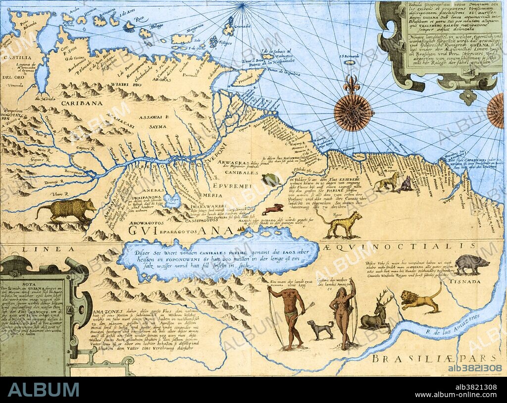
Map of El Dorado and the Amazon, 16th Century

|
Añadir a otro lightbox |
|
Añadir a otro lightbox |


¿Ya tienes cuenta? Iniciar sesión
¿No tienes cuenta? Regístrate
Compra esta imagen.
Selecciona el uso:

Título:
Map of El Dorado and the Amazon, 16th Century
Descripción:
Traducción automática: Mapa de Guyana y Brasil que muestra el río Amazonas, animales salvajes, un hombre sin cabeza "de la tierra Ewaipanoma", una mujer amazónica y el ficticio lago Parime, en cuya orilla norte se encuentra la ciudad de El Dorado. El Dorado era la legendaria "Ciudad Perdida de Oro" que fascinó a los exploradores desde los días de los conquistadores españoles y supuestamente estaba ubicada en el legendario Lago Parime en las tierras altas de Guyana. Este mapa es una adaptación de un mapa ligeramente anterior de Jodocus Hondius, aunque el título indica que el mapa fue "inspeccionado y dibujado por un marinero que acompaña a Walter Raleigh en su viaje" (de 1595).
Map of Guyana and Brazil showing the Amazon river, wild animals, a headless man "of the land Ewaipanoma," an Amazon woman, and the fictitious Lake Parime, on the north shore of which is located the city of El Dorado. El Dorado was the legendary "Lost City of Gold" that fascinated explorers since the days of the Spanish Conquistadors and was supposedly located on the legendary Lake Parime in the highlands of Guyana. This map is adapted from a slightly earlier map by Jodocus Hondius, although the title states that the map was 'surveyed and drawn by a sailor who accompanies Walter Raleigh on his voyage' (of 1595).
Crédito:
Album / Science Source / Getty Research Institute
Autorizaciones:
Modelo: No - Propiedad: No
¿Preguntas relacionadas con los derechos?
¿Preguntas relacionadas con los derechos?
Tamaño imagen:
5315 x 3951 px | 60.1 MB
Tamaño impresión:
45.0 x 33.5 cm | 17.7 x 13.2 in (300 dpi)
Palabras clave:
AMAZÓNICO • ANIMALES SALVAJES • ARTE • BRASIL • COLONIAL • COLOR • COSTA • DIBUJO • DORADO EL • GRABADO • GUAYANA • HISTORIA • HISTORICO • INDIAS OCCIDENTALES • INDÍGENA • LEGENDARIO • MAPA ANTIGUO • MAPA • MEJORA • MEJORAR • MÍTICO • OBRA DE ARTE • RIO AMAZONAS • S. XVI • SIGLO XVI • SUDAMERICA • TRINIDAD Y TOBAGO • TRINIDAD
 Pinterest
 Twitter
 Facebook
 Copiar enlace
 Email
Email
