alb3802898
Medieval World Map, 13th Century
| Compartir |
|---|
 Pinterest Pinterest |
 Twitter Twitter |
 Facebook Facebook |
 Copiar enlace Copiar enlace |
 Email Email |
|
Añadir a otro lightbox |
|
Añadir a otro lightbox |


¿Ya tienes cuenta? Iniciar sesión
¿No tienes cuenta? Regístrate
Compra esta imagen.
Selecciona el uso:

Título:
Medieval World Map, 13th Century
Descripción:
Ver traducción automática
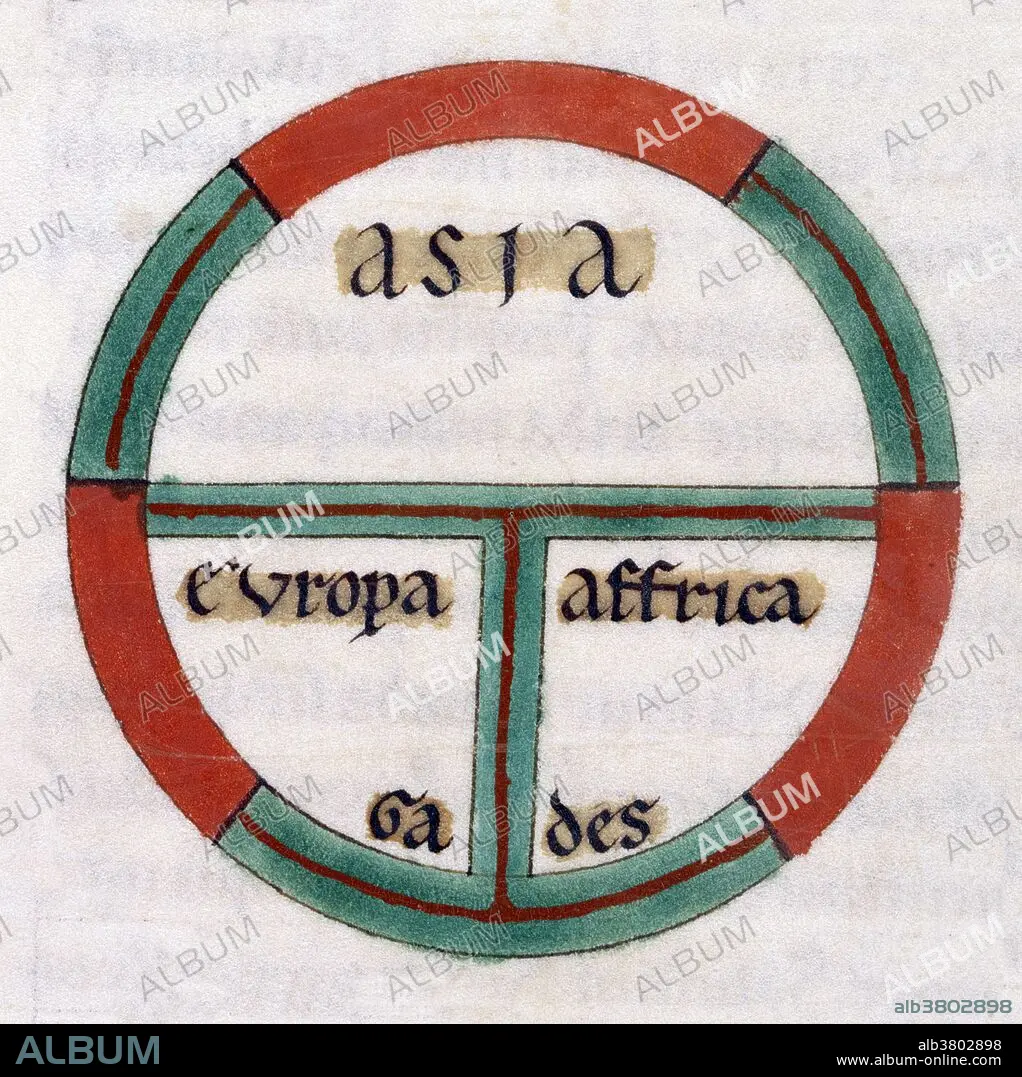
Diagrammatic T-O map. The world portrayed as a circle divided by a T shape into three continents, Asia, Europe, and Africa. At the base of the circle is Gades. A T and O map or O-T or T-O map (orbis terrarum, orb or circle of the lands; with the letter T inside an O), is a type of medieval world map, sometimes also called a Beatine map or a Beatus map because one of the earliest known representations of this sort is attributed to Beatus of Liébana, an 8th century Spanish monk. The T is the Mediterranean, the Nile, and the Don (formerly called the Tanais) dividing the three continents, Asia, Europe and Africa, and the O is the encircling ocean.
Crédito:
Album / Science Source / British Library
Autorizaciones:
Tamaño imagen:
3750 x 3758 px | 40.3 MB
Tamaño impresión:
31.8 x 31.8 cm | 12.5 x 12.5 in (300 dpi)
Palabras clave:
AFRICA • ARTE • ASIA • CARTOGRAFIA • CIENCIA • DIAGRAMA • DIBUJO • EDAD MEDIA • EUROPA • HISTORIA • HISTORICO • ILUSTRACION • MAPA DEL MUNDO • MAPA MUNDI • MAPA • MAPAMUNDI • OBRA DE ARTE • S. XIII • SIGLO XIII
