alb1962842
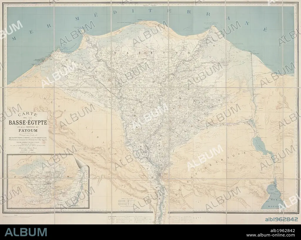
Low-Egypt and Fayoum. Carte de la Basse-Egypte et de la Province du Fayo. Cairo, 1897. Chart of Low-Egypt and the Province of Fayoum. Image taken from Carte de la Basse-Egypte et de la Province du Fayoum. Dressée par MM. Audebeau, Souter et Colani Dessinée par L. Se´mat Échelle de 1 : 200,000. Originally published/produced in Cairo, 1897. . Source: Maps.64390.(22),. Language: French.
| Compartir |
|---|
 Pinterest Pinterest |
 Twitter Twitter |
 Facebook Facebook |
 Copiar enlace Copiar enlace |
 Email Email |
|
Añadir a otro lightbox |
|
Añadir a otro lightbox |


¿Ya tienes cuenta? Iniciar sesión
¿No tienes cuenta? Regístrate
Compra esta imagen.
Selecciona el uso:

Descripción:
Ver traducción automática
Low-Egypt and Fayoum. Carte de la Basse-Egypte et de la Province du Fayo. Cairo, 1897. Chart of Low-Egypt and the Province of Fayoum. Image taken from Carte de la Basse-Egypte et de la Province du Fayoum. Dressée par MM. Audebeau, Souter et Colani Dessinée par L. Se´mat Échelle de 1 : 200,000. Originally published/produced in Cairo, 1897. . Source: Maps.64390.(22),. Language: French.
Crédito:
Album / British Library
Autorizaciones:
Modelo: No - Propiedad: No
¿Preguntas relacionadas con los derechos?
¿Preguntas relacionadas con los derechos?
Tamaño imagen:
10000 x 7468 px | 213.7 MB
Tamaño impresión:
84.7 x 63.2 cm | 33.3 x 24.9 in (300 dpi)
Palabras clave:
AFRICA DEL NORTE • AFRICA NORTE • AFRICA • CAIRO • CARTOGRAFIA • EGIPCIA • EGIPCIAS • EGIPCIO • EGIPTO • EL CAIRO • GRAFICO • MAPA • NORTE AFRICA • NORTE DE AFRICA • NORTH AFRICA
