alb5407543
Joan Blaeu, Duchies of Bremen-Verden Map, 17th Century
| Compartir |
|---|
 Pinterest Pinterest |
 Twitter Twitter |
 Facebook Facebook |
 Copiar enlace Copiar enlace |
 Email Email |
|
Añadir a otro lightbox |
|
Añadir a otro lightbox |


¿Ya tienes cuenta? Iniciar sesión
¿No tienes cuenta? Regístrate
Compra esta imagen.
Selecciona el uso:

Título:
Joan Blaeu, Duchies of Bremen-Verden Map, 17th Century
Descripción:
Ver traducción automática
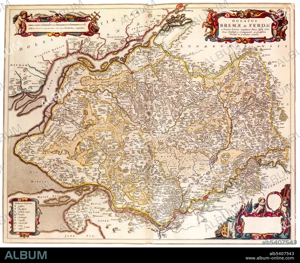
Bremen-Verden, formally the Duchies of Bremen and Verden, were two territories and immediate fiefs of the Holy Roman Empire, which emerged and gained imperial immediacy in 1180. In 1648, both prince-bishoprics were transformed into hereditary monarchies by constitution, and from then on both the Duchy of Bremen and the Duchy of Verden were always ruled in personal union. With the dissolution of the Holy Roman Empire in 1806, Bremen-Verden's status as fiefs of imperial immediacy became void. Joan Blaeu (1596-1673) was a Dutch cartographer, the son of cartographer Willem Blaeu. In 1635 they published the Atlas Novus (full title: Theatrum orbis terrarum, sive, Atlas novus) in two volumes. The Atlas Maior is the final version of Joan Blaeu's atlas, published in Amsterdam between 1662 and 1672, in Latin, French, Dutch, German and Spanish, containing 594 maps and around 3,000 pages of text.
Crédito:
Album / Science Source
Autorizaciones:
Modelo: No - Propiedad: No
¿Preguntas relacionadas con los derechos?
¿Preguntas relacionadas con los derechos?
Tamaño imagen:
4125 x 3401 px | 40.1 MB
Tamaño impresión:
34.9 x 28.8 cm | 13.7 x 11.3 in (300 dpi)
Palabras clave:
ATLAS • CARTOGRAFIA • CARTOGRAFICO • DORADO • DUCADO • EDAD • FAMOSA • FAMOSO • GEOGRAFIA • GEOGRAFICA • GEOGRAFICO • HISTORIA • HISTORICO • HOLANDES • JOAN • MAPA • SIGLO XVII • SIGLO
