alb9331249
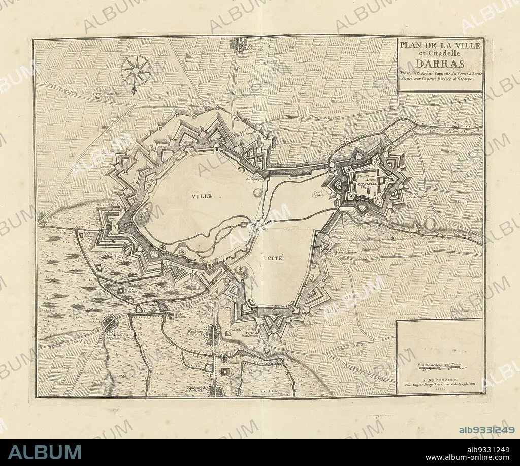
Map of Arras, 1710, Plan de la Ville et Citadelle d'Arras (title on object), Map of Arras, 1710. Part of a bundled collection of plans of battles and cities renowned in the War of the Spanish Succession., print maker: Jacobus Harrewijn (attributed to), publisher: Eugene Henry Fricx (mentioned on object), Brussels, 1710, paper, etching, height 398 mm × width 500 mm.
| Compartir |
|---|
 Pinterest Pinterest |
 Twitter Twitter |
 Facebook Facebook |
 Copiar enlace Copiar enlace |
 Email Email |
|
Añadir a otro lightbox |
|
Añadir a otro lightbox |


¿Ya tienes cuenta? Iniciar sesión
¿No tienes cuenta? Regístrate
Compra esta imagen.
Selecciona el uso:

Descripción:
Ver traducción automática
Map of Arras, 1710, Plan de la Ville et Citadelle d'Arras (title on object), Map of Arras, 1710. Part of a bundled collection of plans of battles and cities renowned in the War of the Spanish Succession., print maker: Jacobus Harrewijn (attributed to), publisher: Eugene Henry Fricx (mentioned on object), Brussels, 1710, paper, etching, height 398 mm × width 500 mm
Personas:
Crédito:
Album / quintlox
Autorizaciones:
Modelo: No - Propiedad: No
¿Preguntas relacionadas con los derechos?
¿Preguntas relacionadas con los derechos?
Tamaño imagen:
4444 x 3748 px | 47.7 MB
Tamaño impresión:
37.6 x 31.7 cm | 14.8 x 12.5 in (300 dpi)
