alb4203956
city map from the year 1892
| Compartir |
|---|
 Pinterest Pinterest |
 Twitter Twitter |
 Facebook Facebook |
 Copiar enlace Copiar enlace |
 Email Email |
|
Añadir a otro lightbox |
|
Añadir a otro lightbox |


¿Ya tienes cuenta? Iniciar sesión
¿No tienes cuenta? Regístrate
Compra esta imagen.
Selecciona el uso:

Título:
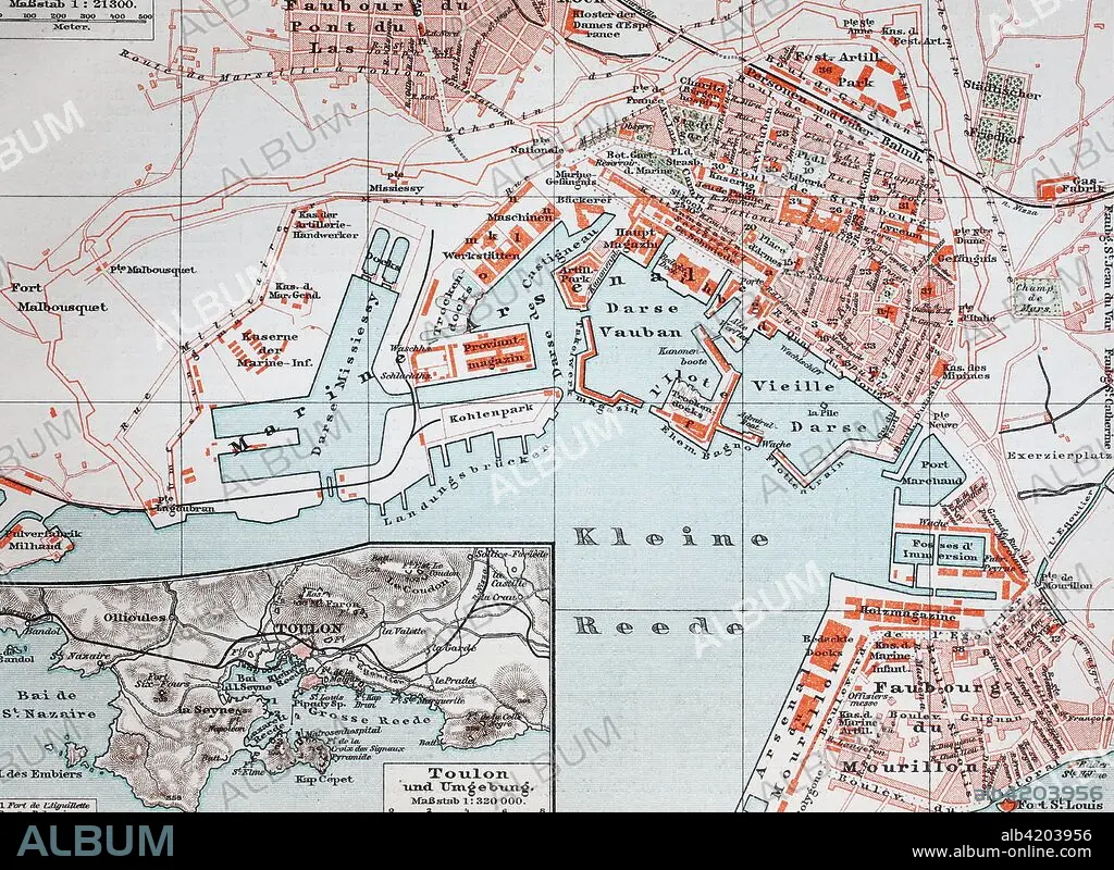
city map from the year 1892
Descripción:
Ver traducción automática
city map from the year 1892: Toulon, France, digital improved reproduction of an original print from the year 1895
Crédito:
Album / Universal Images Group / Bildagentur/UIG
Autorizaciones:
Modelo: No - Propiedad: No
¿Preguntas relacionadas con los derechos?
¿Preguntas relacionadas con los derechos?
Tamaño imagen:
3548 x 2587 px | 26.3 MB
Tamaño impresión:
30.0 x 21.9 cm | 11.8 x 8.6 in (300 dpi)
Palabras clave:
ANTIGUO • ANTIGUOS • CALLE • CIUDAD • EUROPA • IMPRESION • MAPA DE CARRETERAS • MAPA URBANO • MAPA • PROVENCE-ALPES-COSTA AZUL • PROVENZA • PROVENZAL • PUEBLO • SIMBÓLICA • SIMBÓLICO • TOULON • VISIÓN GENERAL
