alb4057434
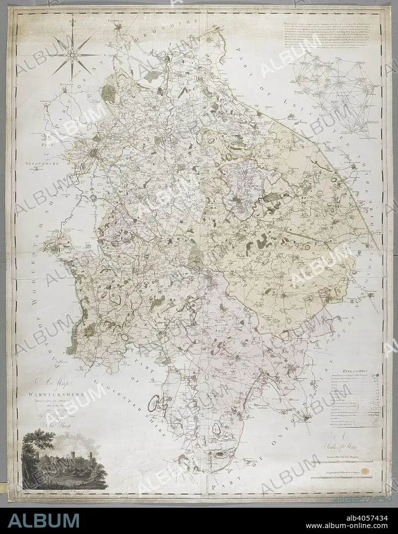
WILLIAM YATES AND SONS. A Map of Warwickshire, 1787. A Map of Warwickshire, drawn from an actual survey taken in the years 1787, 8, 9 by W. Yates and Sons. Warwick, 1793. Source: Maps K.Top.42.76.11.Tab.
| Compartir |
|---|
 Pinterest Pinterest |
 Twitter Twitter |
 Facebook Facebook |
 Copiar enlace Copiar enlace |
 Email Email |
|
Añadir a otro lightbox |
|
Añadir a otro lightbox |


¿Ya tienes cuenta? Iniciar sesión
¿No tienes cuenta? Regístrate
Compra esta imagen

Autor:
Descripción:
Ver traducción automática
A Map of Warwickshire, 1787. A Map of Warwickshire, drawn from an actual survey taken in the years 1787, 8, 9 by W. Yates and Sons. Warwick, 1793. Source: Maps K.Top.42.76.11.Tab.
Crédito:
Album / British Library
Autorizaciones:
Modelo: No - Propiedad: No
¿Preguntas relacionadas con los derechos?
¿Preguntas relacionadas con los derechos?
Tamaño imagen:
8296 x 10595 px | 251.5 MB
Tamaño impresión:
70.2 x 89.7 cm | 27.7 x 35.3 in (300 dpi)
Palabras clave:
ALBION • CARTOGRAFIA • CARTOGRAFICO • COLOR • COLORES • COLORIDO • EUROPA OCCIDENTAL • EUROPA • GRAN BRETAÑA • INGLATERRA • ISLAS BRITANICAS • MAPA • S. XVIII • SIGLO XVIII • YATES AND SONS, WILLIAM
