alb3549034
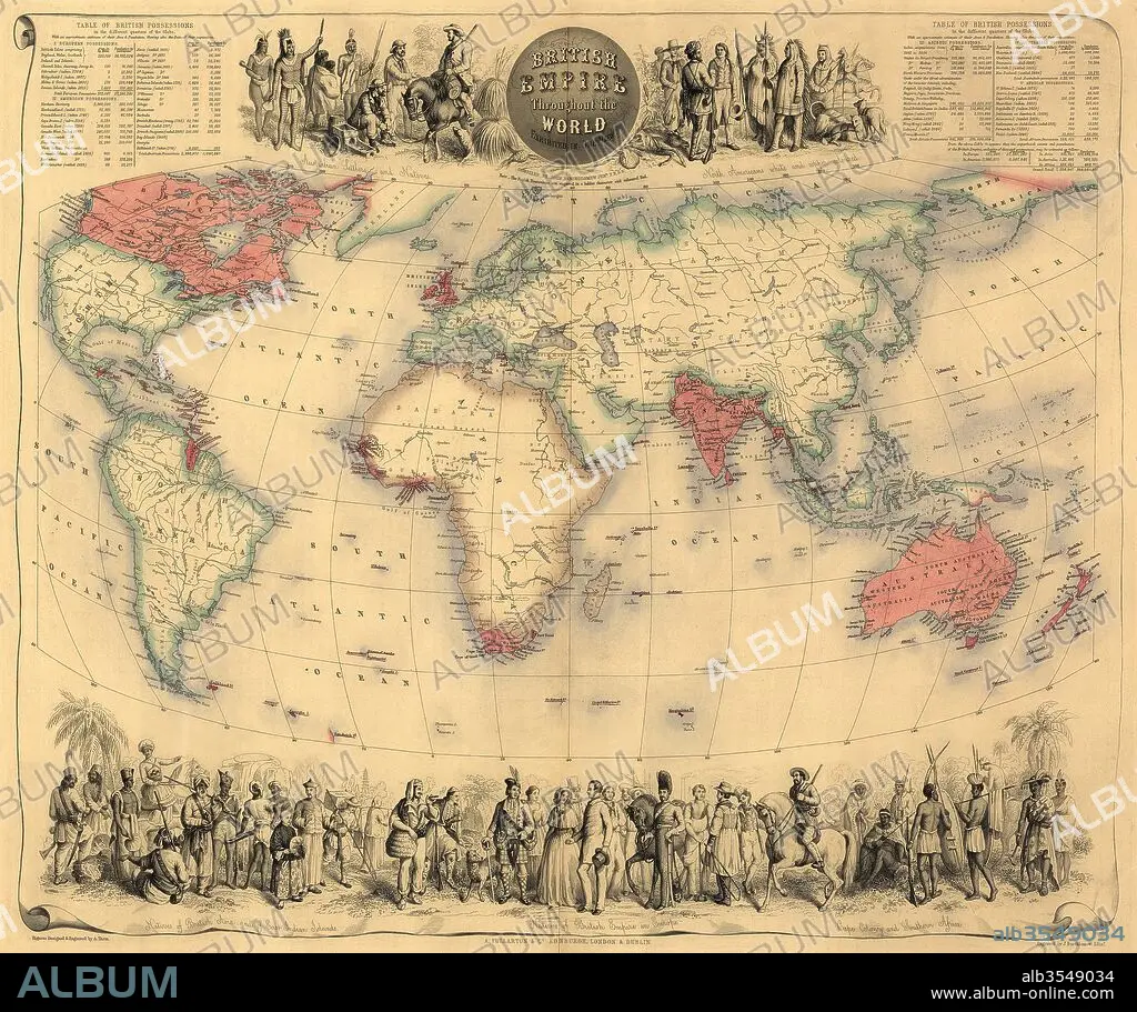
Map of the world circa 1870 with possessions of the British Empire coloured red
| Compartir |
|---|
 Pinterest Pinterest |
 Twitter Twitter |
 Facebook Facebook |
 Copiar enlace Copiar enlace |
 Email Email |
|
Añadir a otro lightbox |
|
Añadir a otro lightbox |


¿Ya tienes cuenta? Iniciar sesión
¿No tienes cuenta? Regístrate
Compra esta imagen.
Selecciona el uso:

Título:
Map of the world circa 1870 with possessions of the British Empire coloured red
Descripción:
Ver traducción automática
Map of the world circa 1870 with possessions of the British Empire coloured red. The map first appeared in Fullarton's Royal Illustrated Atlas, published 1864.
Crédito:
Album / Universal Images Group / Universal History Archive
Autorizaciones:
Modelo: No - Propiedad: No
¿Preguntas relacionadas con los derechos?
¿Preguntas relacionadas con los derechos?
Tamaño imagen:
5115 x 4287 px | 62.7 MB
Tamaño impresión:
43.3 x 36.3 cm | 17.1 x 14.3 in (300 dpi)
Palabras clave:
1870 • BRITANICA • BRITANICO • BRITANICOS • CARTOGRAFIA • COLOR • COLORIDO • DECORATIVO • EN TODO EL MUNDO • GRAFICO • GRAN BRETAÑA • HACÍA • ILUSTRADO • IMPERIO BRITANICO • IMPERIO • INGLATERRA • INGLES • INGLESA • INGLESES • MAPA • MUNDO • POSESIONES • REINO UNIDO • S. XIX • SIGLO XIX • SIGLO
