alb1656551
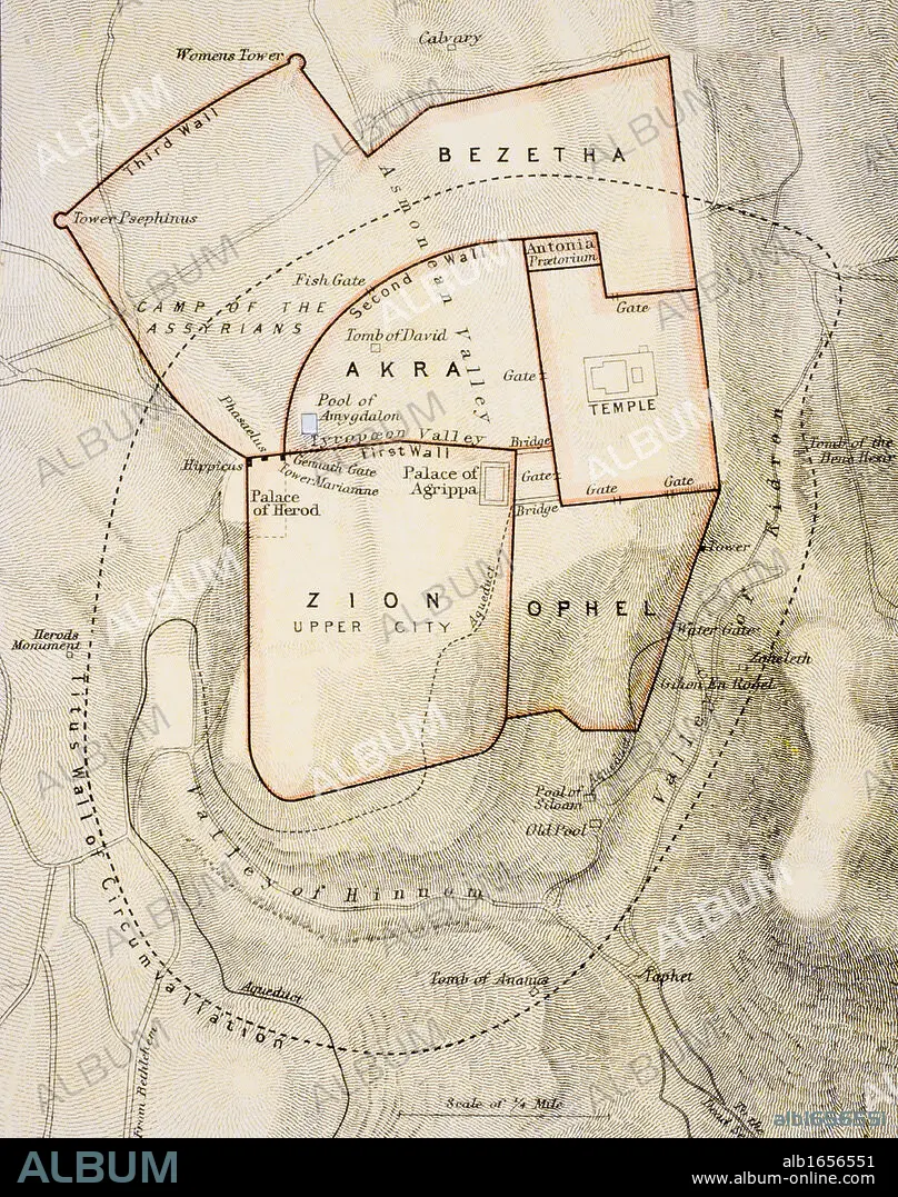
City map of ancient Jerusalem From The Citizen's Atlas of the World published London circa 1899.
| Compartir |
|---|
 Pinterest Pinterest |
 Twitter Twitter |
 Facebook Facebook |
 Copiar enlace Copiar enlace |
 Email Email |
|
Añadir a otro lightbox |
|
Añadir a otro lightbox |


¿Ya tienes cuenta? Iniciar sesión
¿No tienes cuenta? Regístrate
Compra esta imagen

Descripción:
Ver traducción automática
City map of ancient Jerusalem From The Citizen's Atlas of the World published London circa 1899
Crédito:
Album / Universal History Archive/Universal Images Group
Autorizaciones:
Modelo: No - Propiedad: No
¿Preguntas relacionadas con los derechos?
¿Preguntas relacionadas con los derechos?
Tamaño imagen:
3822 x 4843 px | 53.0 MB
Tamaño impresión:
32.4 x 41.0 cm | 12.7 x 16.1 in (300 dpi)
